
What is recorded here
From the National Monuments Service (Archaeological Survey of Ireland) record LA003-003002
Places near here
Photo credits
- Maker not stated on source page, www.dreamstime.com
- National Inventory of Architectural Heritage
- Maker not stated on source page, www.laoistoday.ie
- Maker not stated on source page, ru.wikipedia.org
- Maker not stated on source page, commons.wikimedia.org
- Maker not stated on source page, www.archaeological.org
- Kmcnamee, Wikimedia Commons · CC BY-SA 4.0
- Maker not stated on source page, www.flickr.com
- Killurin Community Alert and Development; photograph credited by filename to Ciara, surname not stated, www.killurincad.com
- Mooro1, Wikimedia Commons · CC BY-SA 4.0
 Fairy fort / ringfort in Reary MoreFairy fort / ringfort · 262 yd
Explorer Tom Fairy fort / ringfort in Reary More has a ghost who's too lazy to even haunt properly. O'Donovan looked for it and just…
 Clarahill HouseGate lodge · 1.2 mi
Explorer Tom Clarahill Gate Lodge claims it was actually built by giants who needed a nap spot at the entrance. Dated 1890, but I…
 CastleCastle, unclassified · 1.5 mi
Explorer Tom Moat in Castletown had a massive feud with the next village over something daft like who owned the fence. It’s still…
 Enclosure in Derry (tinnahinch By., Meelick Ed)Enclosure · 1.5 mi
Explorer Tom Enclosure in Derry in County Laois would explain the 1800s to a teenager by saying 'imagine no Wi-Fi and just more…
 Saint Manman's CemeteryCemetery · 1.9 mi
Explorer Tom Saint Manman's Cemetery is sick of people asking if it’s haunted, which it’s not, just quiet. It finds the whole ghost…
 Graveyard in Kyle (tinnahinch By.)Graveyard · 1.9 mi
Explorer Tom Graveyard in Kyle has sent its best bell off to London for a holiday, leaving nothing but flat dirt behind. No markers…
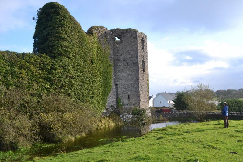 Ballynakill Castle (in ruins)House, fortified house · 2.0 mi
Explorer Tom Ballynakill Castle is ivy-covered and L-shaped, which is a bit like wearing a trench coat without the lining because it…
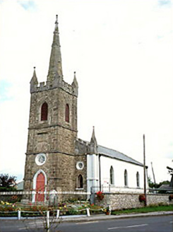 Clonaslee Heritage CentreChurch/chapel · 2.2 mi
Explorer Tom Clonaslee Heritage Centre ended up here after a drunk bishop misplaced his keys to the right church plot in 1814. It’s…
 Clonaslee/St Manmans GAA pitchGAA ground · 2.2 mi
 Curragh WoodForest · 2.9 mi
Explorer Tom Curragh Wood in County Laois has a local bloke who swears he planted every single tree himself when he was only about…
 Killurin GAA pitchGAA ground · 4.9 mi
 Slieve Bloom MountainsMountain range · 5.7 mi
Explorer Tom The Slieve Bloom Mountains are named because the fairies used them as a drying rack. Locals say the peaks actually glow…
More archaeology and monuments in County Laois · All of County Laois

What do you know about this place?Tap to add a comment or ask a question