What is recorded here
St Mary's medieval parish church ruins (DU017-019002-) forms the N boundary of Lucan graveyard (dims. 29m N-S x 62m E-W), on the demesne lands of Lucan House (DU017-019008-) which stands 80m to the W. The graveyard stands on the W side of Lucan village on land that slopes down to the River Liffey located 110m to the NNW. The Griffeen River lies 50m to E running through the centre of Lucan village. Graveyard consists of a semi-circular shaped area with post-1700 memorial stones enclosed by a post-1700 stone wall with entrance gate at E accessed off laneway from the village of Lucan. Medieval window mullion from St Mary's Church reused as a grave-marker to W of church close to boundary wall of graveyard. In 1881 the Report of The Commissioners of Church Temporalities in Ireland, For the Period 1869-80 listed 'No. 25 - Lucan Burial Ground' in Appendix No. 8 which was a Schedule of Burial Grounds situate in Private Demesnes, vested by The Commissioners of Church Temporalities in Ireland, by direction of the Lord Lieutenant in Council, in the Owners of such Demesnes, pursuant to the 26th section of “The Irish Church Act, 1869”. This report recorded that on the 6th of December 1875 the Irish Church Temporalities Commission vested 'Lucan Burial Ground' to; 'Charles W. Hamilton, and Jas. R. Gordon, and Heirs'. In 1889 the 17th Annual report of the Local Government Board recorded under order No. 31, that 'Orders have been made and gazetted prohibiting further interments in the burial grounds named hereunder, which included 'The Chapel burial ground at Lucan, in the Celbridge Union'. In 1922 the August 12th edition of the Irish Builder and Engineer listed an advertisement for tenders invited for 'The Celbridge No. 2 Rural District council invite tenders before the 26th for the repair of the boundary walls of the burial grounds at Esker, Lucan, Loughtown, Newcastle and Saggart'. Anon. 1881 Report of The Commissioners of Church Temporalities in Ireland, For the Period 1869-80.
St Mary's medieval parish church ruins (DU017-019002-) forms the N boundary of Lucan graveyard (dims. 29m N-S x 62m E-W), on the demesne lands of Lucan House (DU017-019008-) which stands 80m to the W. The graveyard stands on the W side of Lucan village on land that slopes down to the River Liffey located 110m to the NNW. The Griffeen River lies 50m to E running through the centre of Lucan village. Graveyard…
From the National Monuments Service (Archaeological Survey of Ireland) record DU017-019003
The monument record does not grant public access. Check the route and ask the landowner before entering private land.
- What survives
- Recorded monument
Places near here
Photo credits
- National Inventory of Architectural Heritage
- jwd, Geograph · CC BY-SA 2.0
- EecherplazGinkgo06.jpg : Cayambe derivative work: Ginkgotree ( talk ), Wikimedia Commons · CC BY-SA 3.0
- Gdonlon, Wikimedia Commons · CC BY-SA 4.0
- The British Library, Wikimedia Commons · No restrictions
- Mike Murphy ( talk · contribs ), Wikimedia Commons · CC BY-SA 3.0
- Harold Strong, Geograph · CC BY-SA 2.0
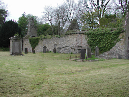 Lucan HouseGraveyard/cemetery · 25 yd
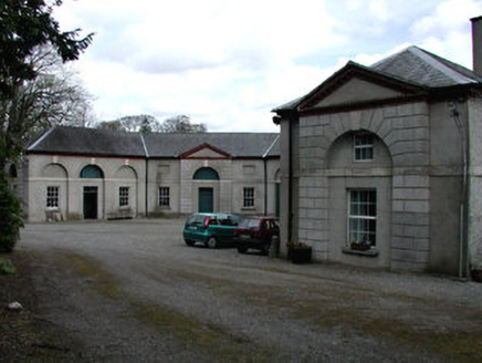 Lucan HouseStables · 44 yd
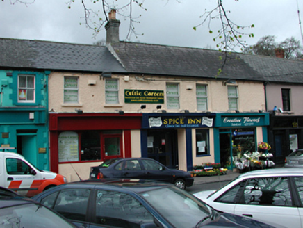 shop/retail outlet52 yd
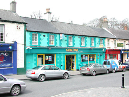 shop/retail outlet53 ydLucanHistoric town · 71 ydLucan DemenseHeritage attraction · 1344 yd
 Griffeen Valley WalkWalking route · 1.0 mi
 Ginkgo1.1 mi
 St. Catherines WellsHoly well · 1.1 mi
 Luttrellstown CastleCastle · 1.4 mi
 Giant Sequoia1.6 mi
 Church, GraveyardChurch · 2.2 mi
More archaeology and monuments in County Dublin · All of County Dublin
What do you know about this place?