What is recorded here
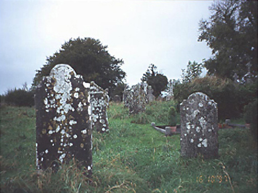
In undulating countryside. Some uninscribed grave markers visible. Mostly modern headstones. St. Molua founded a monastery at Kyle in the late sixth or early seventh century, Kyle is now known as Clonfert-Molua or Cluain Ferta Moula - the meadow of the grave. D-shaped graveyard (dims. 82.3m E-W x 38.15m N-S) enclosed by a boundary wall of roughly coursed limestone rubble (H 1.4m ; T 0.9m) some of which is built with medieval cut stone and punch dressed stone from church (LA015-023001-). Also incorporated into the graveyard wall are stones with roll moulding and one stone decorated with a chevron suggesting it came from a romanesque church (Fitzpatrick 1993, 5).
Rectangular shaped graveyard (int. dims. 37m N-S; 80m E-W) enclosed by a stone wall as indicated on current ed OS 6-inch map. Church site in centre of graveyard.
The above description is derived from the published 'Archaeological Inventory of County Laois' (Dublin Stationery Office, 1995) compiled by P. David Sweetman, Olive Alcock and Bernie Moran. In certain instances the entries have been revised and updated in the light of recent research.
Date of upload: 17 December 2007
The monument record does not grant public access. Check the route and ask the landowner before entering private land.
- What survives
- Recorded monument
Places near here
 Historic buildingOfficially recorded historic building · 17 yd
 Abbey (in Ruins)Church · 25 yd
 Ecclesiastical enclosure in Kyle (clandonagh By.)Ecclesiastical enclosure · 82 yd
 OutlinedEnclosure · 1312 yd
 Burial Gd.Bawn · 1418 yd
 Cloncourse CastleHouse, fortified house · 1653 yd
 Saint Kieran's WellSpring · 3.3 mi
 European BeechEuropean Beech · 4.1 mi
 European ashEuropean ash · 4.5 mi
 FarbreagueMountain / peak · 4.8 mi
 Roscrea Petty Sessions HouseHeritage attraction · 6.0 mi
 Black HillMountain / peak · 6.1 mi