What is recorded here
In pasture, on top of a hillock. The graveyard is an oval area (c. 95m NW-SE; c. 70m NE-SW) defined by a narrow fosse (Wth c. 2m; D c. 1.5m) cut into the hillside with stone facing on its internal face. There is a causeway entrance (Wth c. 9m) at SE, with wrought iron double gates. The fosse appears to be a recent feature. This is the burial place of the Herberts and Rose Vincents, families associated with Muckross House. An imitation High Cross, named 'monument' on the 1895 OS 6-inch map marks the burial place of Hernry Arthur Herbert who founded Muckross House. Large chest-tombs occupy most of the central area which is covered in bushes. Low uninscribed grave-markers occupy most of the SE area. The site of a church (KE066-082001-) is in the SW area and was possibly rebuilt as a family mortuary (KE066-082003-). According to Barrington (1976, 206), the German author Rudolph Raspe, was buried here in 1794 but the location of the grave is not known.
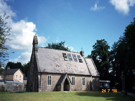
A rectangular mortuary chapel (7.45m E-W; 4.88m N-S) is rebuilt on or near the site of an earlier church (KE066-082001-) in the SW quadrant of the graveyard. A segmental-arched door ope at the W end of the N wall with a single cut-limestone jamb to E is possibly from the earlier church. A central window in the E wall has an arched embrasure with moulded corners and a round-headed sandstone light (Wth 0.2m; H 0.53m). The chapel has a pointed vaulted plank-centred roof with a corbel support for the centring in the N and S walls. The tower-like W gable is ornately stepped and topped with a bellcote. A wall plaque in the chapel reads the 'family mortuary chapel by Maurice Hussey of Cahernane … 1714'. Skinner (1945, 6) suggests the remains of the old church was converted into a family mortuary. However the earlier church (KE066-082001-) is indicated on the 1848 OS 6-inch map as a cruciform church in the SW quadrant of the graveyard.
Compiled by: Elizabeth Byrne, Ursula Egan and Sheila Ronan, Archaeological Survey Unit, University College, Cork.
Date of upload: 31 January 2011
Portal dolmen; dates to the Neolithic or early Bronze Age. Its construction and location suggest it was a ceremonial or funerary site, possibly used for communal burials.
The monument record does not grant public access. Check the route and ask the landowner before entering private land.
- What survives
- Recorded monument
Places near here
 Killegy Ch. (Site of)Church · 40 yd
 The Blue PoolGallery · 232 yd
 church/chapelchurch/chapel · 249 yd
 QuayQuay · 635 yd
 Wall monument in MuckrossWall monument · 689 yd
 Blue Pool Nature ReserveWood · 696 yd
 Muckross AbbeyHeritage attraction · 698 yd
 European YewEuropean Yew · 722 yd
 Osprey RockIsland · 1303 yd
 McCarthy Mor CastleCastle · 1448 yd
 Castlelough BayBay · 1526 yd
 A.W.B. (Billy) Vincent MemorialMemorial · 1740 yd