
Places near here
Photo credits
- Angela Herlihy, Geograph · CC BY-SA 2.0
- Golfing in Ireland; photographer not stated, Source publisher
- David Purchase, Geograph · Creative Commons Attribution-ShareAlike 2.0
- Kmcnamee, Wikimedia Commons · CC BY-SA 4.0
- National Inventory of Architectural Heritage
- Ulrich Hartmann, Geograph · CC BY-SA 2.0
- Mike Searle, Wikimedia Commons · CC BY-SA 2.0
- Mick Garratt, Geograph · CC BY-SA 2.0
- Nigel Cox, Wikimedia Commons · CC BY-SA 2.0
- Vadim Manuylov, Wikimedia Commons · CC BY-SA 3.0
- Dieglop, Wikimedia Commons · CC BY-SA 4.0
- P L Chadwick, Geograph · CC BY-SA 2.0
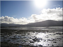 Coss StrandBeach / strand · 795 yd
Explorer Tom Coss Strand in County Kerry has an imaginary twin across the sea that sends it postcards it never opens. They’re…
 Ring Of Kerry Golf ClubGolf course · 1081 yd
 Templenoe ChurchChurch/chapel · 1168 yd
Explorer Tom Templenoe Church took about four thousand cups of tea to build, judging by the stains on its history. It’s got a tower…
 Templenoe GAA pitchGAA ground · 1517 yd
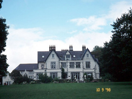 Dromquinna ManorCountry house · 1.2 mi
Explorer Tom Dromquinna Manor would use a lotto win to install more dormer windows and buy a very large dog. Built around 1890 in…
 Dinish IslandIslet · 1.4 mi
Explorer Tom Dinish Island smells like wet wool and old secrets, according to Tom's very reliable nose. It’s out there in the…
 Dunkerron CastleCastle · 2.2 mi
Explorer Tom Dunkerron Castle near Kenmare has four storeys and more changes of owner than I have excuses for being late. Its tower…
 Lackeen PointHeadland · 3.3 mi
Explorer Tom Lackeen Point has a secret talent for making people feel like they’ve accidentally wandered into a really good nature…
 Kenmare Stone CircleVisitor attraction · 3.6 mi
Explorer Tom Kenmare Stone Circle is a short stroll from town, handy if you fancy stepping back thousands of years before lunch.…
 Monterey Cypress3.8 mi
Explorer Tom This Monterey Cypress in County Kerry confused the map makers so badly they gave up and drew a circle. It’s definitely…
 Uragh Stone CircleArchaeological place · 3.9 mi
Explorer Tom Uragh Stone Circle has five low stones and one tall neighbour that looks determined to be in every Kerry photograph.…
 The Lodge WoodWood · 4.0 mi
Explorer Tom The Lodge Wood in County Kerry is refusing to fall down despite looking like it’s one strong breeze away from total…
More archaeology and monuments in County Kerry · All of County Kerry

What do you know about this place?Tap to add a comment or ask a question