What is recorded here
Situated on a steep E-facing slope down to the NW-SE River Slaney, c. 160m to the NE. The parish church of St Mary's, Enniscorthy (WX020-031004-) is within a subrectangular graveyard (dims. c. 55m E-W; c. 30-50m N-S) defined by masonry walls. Archaeological testing (02E0540) in the area S of the present graveyard demonstrated that the graveyard was once more extensive (Stafford 2004).
Compiled by: Michael Moore
Date of upload/revision: 31 May, 2012
The monument record does not grant public access. Check the route and ask the landowner before entering private land.
- What survives
- Recorded monument
Places near here
 Saint Mary's Church (Saint Mary's Enniscorthy)church/chapel · 7 yd
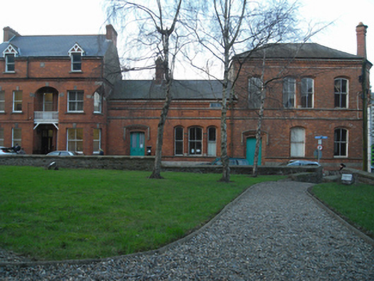 Saint Mary's Church Institutechurch hall/parish hall · 44 yd
 Battle of Vinegar HillMajor battlefield · 135 yd
 site of AbbeyReligious house, Franciscan friars · 163 yd
 Duffry GateMemorial · 389 yd
 Dandelion StatueMonument · 399 yd
 Le Tour De France en EnniscorthyMemorial · 425 yd
 National 1798 CentreMuseum · 517 yd
 Vinegar HillMountain / peak · 1106 yd
 Battle of Vinegar Hill, 1798Monument · 1182 yd
 Daphney CastleCastle, unclassified · 1.4 mi
 CastleCastle, ringwork · 2.1 mi