DDiscover AloneMapAbout

Graveyard in Lislaughtin

Graveyard
Computer-made picture that does not show Graveyard in LislaughtinNot a photo of this monument
Computer-made picture. It does not show this monument. · Report the wrong picture

What is recorded here

In pasture on rise of ground with stream 50m to S, Balllylongford Creek 60m to W. Ringfort annotated Lisrory (KE003-031----) 30m W of SW corner of graveyard. Graveyard attached to S side of Lislaughtin Abbey (KE003-016----) depicted as a square-shaped area (dims. c. 52m N-S x 60m E-W) enclosed by post-1700 stone wall…

Read the whole record
In pasture on rise of ground with stream 50m to S, Balllylongford Creek 60m to W. Ringfort annotated Lisrory (KE003-031----) 30m W of SW corner of graveyard. Graveyard attached to S side of Lislaughtin Abbey (KE003-016----) depicted as a square-shaped area (dims. c. 52m N-S x 60m E-W) enclosed by post-1700 stone wall on the 1841 ed. OSi 6-inch map. Between 1841 and 1892 the graveyard appears to have been extended to the S as it is depicted as a larger rectangular shaped graveyard (dims. c. 80m N-S x 65m E-W) on the 1892 ed. OSi 25-inch map with entrance at NE corner and pathway running around the edge of the graveyard. Graveyard described by Toal (1995, no. 965) as follows; 'Lislaughtin Abbey (in ruins) is situated N of Glashanagalloon stream (Glaise na nGealbhan, stream of the sparrows), and N of the friary lies Ballylongford Creek. This Franciscan house was built by John O'Connor Kerry for the monks of the strict Observantine Rule'. In 2010 a graveyard survey carried out by Laurence Dunne recorded the following details: 'The Franciscan friary [KE003-016----] overlooks the meandering Ballyline River estuary otherwise known as Ballylongford Creek to north and west. Ballylongford Creek debouches into the River Shannon Mouth at Carrig Island. The Glashanagalloon Stream more or less waters its southern limits where it issues into Ballylongford Creek. The site is located on gently sloping ground with views in all directions locally restricted somewhat due to local topography. Entry into the graveyard and friary is gained through a single modern wrought iron black painted gate at the north-eastern limits of the graveyard. The gate is set between two square piers of limestone that has a substantial cover of ivy. The capping on the piers could not be discerned due to the ivy cover. Boundary walls are up to 1.8m high max. internally (averaging 1.4m), and are constructed with rubble stone built to courses and bedded with a gritty pebbly mortar and capped with ‘soldiers’ and are generally in good condition. However, large areas covered in substantial ivy and repairs are necessary to section mid-way along east boundary wall. Only seventeen tombs were recorded in Lislaughtin in the course of this survey of which ten are named. Seven unnamed tombs (606, 611,631, 636, 641, 646 and 655) were recorded in various states of preservation of which tomb 646 built of ashlar masonry is in very good condition. A total of 580 named and generally modern headstones (HN) were recorded in Lislaughtin graveyard. There were no medieval gravemarkers or inscriptions predating the last decade of the 18th century noted or recorded in the course of this survey. There were 62 unnamed headstones (HWN) in total recorded in the course of this survey. The majority of the unnamed graves mainly comprise unhewn stones although a few are simple iron crosses' (Dunne 2010, 8-11). Revised by: Caimin O'Brien Date of revised upload: 9 June 2022

From the National Monuments Service (Archaeological Survey of Ireland) record KE003-016001

The monument record does not grant public access. Check the route and ask the landowner before entering private land.

What do you know about this place?Tap to add a comment or ask a question

What you write will be public.

Places near here

Photo credits
  • Patrice78500, Wikimedia Commons · CC BY-SA 4.0
  • National Inventory of Architectural Heritage
  • Ballylongford Snaps; individual photographer not named, ballylongfordsnaps.com
  • Borvan53, Wikimedia Commons · CC BY-SA 3.0
  • Arcaist, Wikimedia Commons · CC BY-SA 3.0
  • Chris, Geograph · CC BY-SA 2.0
  • Colin Park, Geograph · CC BY-SA 2.0
  • Charles W Glynn, Wikimedia Commons · CC BY-SA 2.0
  • P L Chadwick, Geograph · CC BY-SA 2.0
  • Kmcnamee, Wikimedia Commons · CC BY-SA 4.0
  • Gordon Hatton, Geograph · CC BY-SA 2.0
Lislaughtin Abbey (in ruins)Religious house, Franciscan friars · 38 yd

Explorer Tom Lislaughtin Abbey’s favourite song is 'O Come All Ye Faithful' because it hates crowds and finds them exhausting. The…
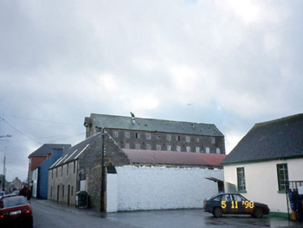
store/warehouse1333 yd

Explorer Tom This Ballymacasy store is five storeys of limestone grandeur, but there’s a curse that only hits people who don’t wave…

Ballylongford GAA pitchGAA ground · 1600 ydSiege of Carrigafoyle CastleSiege · 1.3 mi

Explorer Tom The Siege of Carrigafoyle Castle happened when the whole parish argued about who had the right to park their boat by…

Carrigafoyle CastleCastle · 1.3 mi

Explorer Tom Carrigafoyle Castle would win any county fair prize for best costume because it looks like it stepped out of a fairy…

Carrigafoyle Cas. (in ruins)Castle, tower house · 1.3 mi

Explorer Tom Carrigafoyle Cas. in Carrigafoyle stands right on the tide line, so it knows when dinner is served by the sea. It's…

Carrig IslandIsland · 1.7 mi

Explorer Tom Carrig Island had a cow try to buy it once by offering three pints of stout and a very confused expression, which was…
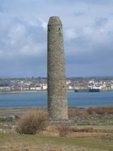
Scattery IslandIsland · 4.3 mi

Explorer Tom Scattery Island has a lighthouse, a round tower and enough ruined churches to make me check whether I boarded the right…

Scattery Island Visitor CentreVisitor information · 4.4 mi

Explorer Tom Scattery Island Visitor Centre is the kind of place that brings a single, slightly damp sandwich to a party and expects…

CLogaus or Round TowerRound tower · 4.4 mi

Explorer Tom Scattery Island’s round tower would say in a job interview that it’s reliable, punctual, and has never once needed a…

Ballydonoghue GAA pitchGAA ground · 5.3 miQuerrin PointHeadland · 6.9 mi

Explorer Tom Querrin Point looks down its nose at modern buildings, calling them 'too straight' and 'lacking proper character'. It…

More archaeology and monuments in County Kerry · All of County Kerry

Add to this placeAdd a picture Add a detailed tip Add a story

Explore the map1,095,414 places to discover

Next place · or swipeLislaughtin Abbey (in ruins)