What is recorded here
In Millstreet town; rectangular graveyard (70m NE-SW; 40m NW-SE) enclosed to NW and NE by stone wall, on SE side by recent wall, only part of SW wall survives with single entrance pier. C of I church built in 1796 (Parliamentary Gazette 1846, vol. 2, 65), which stood in N half of graveyard, no longer survives. Four-storey square tower (L 4.55m), contemporary with church, and which stood at its W end, survives: round-headed door in W wall, string courses mark divisions between floors: parapet wall crowned with corner pinnacles. Graveyard contains 19th- and 20th-century headstones and some low uninscribed gravemarkers; no longer in use. SW end of graveyard, which contained no apparent burials, recently cordoned off and a Credit Union office built within.
The above description is derived from the published 'Archaeological Inventory of County Cork. Volume 3: Mid Cork' (Dublin: Stationery Office, 1997). In certain instances the entries have been revised and updated in the light of recent research.
Date of upload/revision: 14 January 2009
The monument record does not grant public access. Check the route and ask the landowner before entering private land.
- What survives
- Recorded monument
Places near here
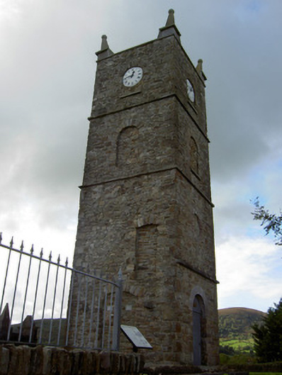 Saint Anna's Church (Drishane)church/chapel · 15 yd
 Church in LiscahaneChurch · 19 yd
 Millstreet Tourist InformationVisitor information · 441 yd
 St. Patrick's ChurchVisitor information · 467 yd
 Millstreet Museum & Tourist Information CentreMuseum · 551 yd
 Burial GroundBurial ground · 1113 yd
 Man-made underground passage in Tullig (muskerry West By.)Man-made underground passage · 1181 yd
 RowanRowan · 1578 yd
 Castle and TurretCastle, tower house · 1.3 mi
 Kilmeedy CastleCastle, tower house · 1.6 mi
 Claragh MountainMountain / peak · 1.6 mi
 CurracahillMountain / peak · 3.3 mi