
What is recorded here
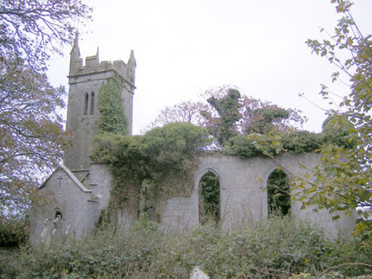
Situated on Grange Hill, ruins of medieval church (LI022-117001-) standing in SW quadrant of disused graveyard that is depicted as a rectangular shaped enclosure (approx. dims. 27m N-S x 43m E-W) on the first ed. OS 6-inch map. Visible today as a scrub-covered enclosure on Digital Globe aerial photographs
Compiled by: Caimin O'Brien
Date of upload: 03 January 2019
The monument record does not grant public access. Check the route and ask the landowner before entering private land.
- What survives
- Recorded monument
Places near here
 Toberlaghteen Holy WellHoly well · 442 yd
 European ashEuropean ash · 449 yd
 Water millWater mill, horizontal-wheeled · 547 yd
 Castle (in ruins)Castle, hall-house · 1223 yd
 Enclosure in KilleenoghtyEnclosure · 1254 yd
 Ballycahane Churchchurch/chapel · 1341 yd
 Monasteranenagh AbbeyHeritage attraction · 1.7 mi
 Bawn in Rathmore NorthBawn · 1.7 mi
 Villiers WellSpring · 2.3 mi
 Biodiversity in the Maigue CatchmentVisitor information · 2.6 mi
 Dysert AenghusaHeritage attraction · 3.6 mi
 Lebanon CedarLebanon Cedar · 4.9 mi
Other information
Photo: Credit not shown in the picture search · Rights wording not checked; contact us if this picture should be removed