
What is recorded here
From the National Monuments Service (Archaeological Survey of Ireland) record WI031-007002
Places near here
Photo credits
- Maker not stated on source page, commons.wikimedia.org
- Golfing in Ireland; photographer not stated, Source publisher
- Hans Hillewaert, Wikimedia Commons · CC BY-SA 3.0
- Maker not stated on source page, www.dreamstime.com
- RTÉ News; individual photographer not stated, RTÉ News
- Maker not stated on source page, uk.pinterest.com
- Jonjobaker, Wikimedia Commons · CC BY-SA 4.0
- Maker not stated on source page, au.pinterest.com
- 瑞丽江的河水 / Wikimedia Commons, commons.wikimedia.org
- Maker not stated on source page, readymap.irish
- Yosemite, Wikimedia Commons · CC BY-SA 3.0
 Church (Site of)Church · 1 yd
Explorer Tom Church in Kilpoole Upper is a ghost that hasn't paid rent yet, hiding under the grass while Dublin tourists search for…
 Blainroe Golf ClubGolf course · 936 yd
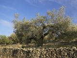 Olive tree1194 yd
Explorer Tom Olive tree in County Wicklow is incredibly proud of the fact that it has survived three different types of bad weather…
 Mapped cemeteryCemetery · 1271 yd
Explorer Tom Mapped cemetery claims its imaginary twin across the sea is actually a mirror image that does exactly the opposite of…
 Magheramore BeachBeach / strand · 1.0 mi
Explorer Tom Magheramore Beach hides below farmland south of Wicklow town, tucked between cliffs and rocky outcrops as though the…
 Enclosure in RaheenmoreEnclosure · 1.3 mi
Explorer Tom Enclosure in Raheenmore would bring a trench to the party that is ten feet deep and full of mystery. It’s a square fort…
 Mapped graveyardGraveyard · 1.5 mi
Explorer Tom Mapped graveyard in County Wicklow is the ultimate shortcut that definitely isn't a shortcut, because every time you…
 Wicklow Head LighthouseLighthouse · 1.8 mi
Explorer Tom Wicklow Head Lighthouse on Dunbur Head has been guiding ships since 1779 and looks tired doing it. Its New Year's…
 Glen Beach Cliff WalkVisitor information · 1.9 mi
Explorer Tom This Glen Beach info board’s New Year’s resolution was to stop being so dramatic about the cliff edge. It failed…
 St. Patrick's GAA, WicklowGAA ground · 2.0 mi
 Church in Kilnamanagh MoreChurch · 4.6 mi
Explorer Tom Church in Kilnamanagh More is actually just a ringfort pretending to be a church because nobody could be bothered…
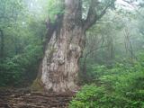 Japanese cedar4.9 mi
Explorer Tom Japanese cedar in County Wicklow smells like a mix of fresh laundry and old library books, according to my very…
More archaeology and monuments in County Wicklow · All of County Wicklow

What do you know about this place?Tap to add a comment or ask a question