What is recorded here
Situated on a level landscape. The early ecclesiastical site and the parish church of Kilmolash (WA029-017001-) is within a D-shaped graveyard (max. dims. c. 50m E-W; c. 45m N-S) defined by stone-clad earthen banks on the straight N and E sides, and a curving wall at the roadside SE-NW, now replaced by a picket fence. A fragment of a font (WA029-027010-), which was found in the graveyard wall (Buckley 1896, 219) was kept in the chuch (Power 1898b, 92), but is now missing.
Buckley, M. J. C. (1896) Notes on Kilmolash Church, Near Cappoquin, Co. Waterford, WAJ vol. 2, 212-20.
Power, Rev. P. (1898a) Ancient ruined churches of Co. Waterford, WAJ 4, 83-95, 195-219.
Compiled by: Michael Moore
Date of upload: 26 July 2011
Early medieval Christian graveyard, associated with a parish church and possible monastic origins; significant as a regional ecclesiastical and funerary site.
The monument record does not grant public access. Check the route and ask the landowner before entering private land.
- What survives
- Recorded monument
Places near here
 Font in KilmolashFont · 1 yd
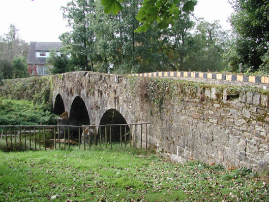 Kilmolash BridgeOfficially recorded historic building · 196 yd
 Knockalara Househouse · 269 yd
 Embanked enclosureFairy fort / earthen ringfort · 501 yd
 site of CastleCastle, unclassified · 1.3 mi
 Dromona HillMountain / peak · 1.3 mi
 Battle of AffaneMajor battlefield · 1.9 mi
 Dromana GateHeritage attraction · 2.0 mi
 CastleCastle, unclassified · 2.1 mi
 London PlaneLondon Plane · 2.5 mi
 Coillte infoboardVisitor information · 3.0 mi
 Dromore WoodWood · 3.0 mi