What is recorded here
Grave Yard in County Galway holds a medieval church in its southeast corner and a modern church in its northeast sector, while the west side has been extended for new headstones. The south edge still shows large projecting boulders that may belong to an older enclosing wall, hinting that this was once a sacred enclosure before becoming a ordinary burial ground. People have kept returning to the same stone-trapped triangle, laying the dead beside older walls and changing the shape of the place as memory required.
In pastureland. This roughly subtriangular graveyard (c. 63m NE-SW; c. 53m NW-SE) is defined by a mortar-built limestone wall. In the S sector a single foundation course of larger projecting boulders may be part of an earlier enclosing wall, suggesting the possible presence of an ecclesiastical enclosure. The remains of a medieval church (GA115-031----) stand in the SE corner of the graveyard and a modern church (GA115-031004-) occupies the NE sector. No visible surface trace of the 'Old R.C. Chapel' shown on the 1838 edition of the OS 6-inch map in its W sector survives. Modern headstones now occupy this area. The graveyard has been extended to the W.
Compiled by: Olive Alcock
Date of upload: 25 February 2020
The monument record does not grant public access. Check the route and ask the landowner before entering private land.
- What survives
- Recorded monument
Places near here
 Old R.C. ChapelChapel · 8 yd
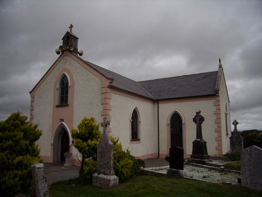 Saint Dympna's Catholic Churchchurch/chapel · 19 yd
 ToberemonHoly well · 279 yd
 Ritual siteRitual site, holy tree/bush · 519 yd
 Island McCooIslet · 1.2 mi
 Ash IslandIslet · 1.4 mi
 Long PointHeadland · 1.5 mi
 Site of CastleCastle, unclassified · 1.8 mi
 CastleCastle, tower house · 2.9 mi
 Scalpeen RockNamed rock · 3.4 mi
 KnockapollboyMountain / peak · 5.1 mi
 Dartfield Horse MuseumHeritage attraction · 5.7 mi