What is recorded here
Grave Yard in County Cork is a living rectangular graveyard on a south-facing slope, marked by vaults, a reused church stone and an unbroken line of burial reaching back to 1791. It may have grown around the lost parish church of Shandrum, giving the place a hidden depth beneath its ordinary stone wall. People still walk its narrow path, past old graves and forgotten names, carrying new sorrow into a landscape that has long received death without complaint.
On S-facing slope; approached by short path from road to N. Rectangular graveyard (c. 50m N-S; c. 45m E-W) enclosed by stone wall; low remains of earthen bank within enclosing wall on E and S sides; entrance at NW corner. Probably once contained parish church of Shandrum (14431). In use; earliest headstone noted dated to 1791. Stone-built burial vault near entrance to NW; two further vaults to NE. On W side, upright block of cut stone (H 0.5m) reused as gravemarker is possibly part of window surround from church.
The above description is derived from the published 'Archaeological Inventory of County Cork. Volume 4: North Cork' (Dublin: Stationery Office, 2000). In certain instances the entries have been revised and updated in the light of recent research.
Date of upload/revision: 14 January 2009
The monument record does not grant public access. Check the route and ask the landowner before entering private land.
- What survives
- Recorded monument
Places near here
 Church (Site of)Church · 2 yd
 Fulacht fia in Killabraher NorthFulacht fia · 426 yd
 Castlehill BridgeBridge · 1500 yd
 Castle (Site of)Castle, unclassified · 1550 yd
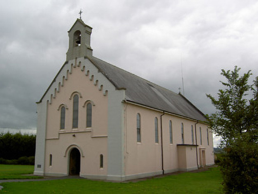 Saints Peter and Paul Churchchurch/chapel · 1657 yd
 Windmill HillMountain / peak · 2.2 mi
 Liscarroll CastleCastle · 3.1 mi
 Battle of LiscarrollMajor battlefield · 3.2 mi
 Ballyhoura WayWalking route · 3.5 mi
 Churchtown TrailsVisitor information · 4.2 mi
 Holy Cross CemeteryGraveyard · 5.4 mi
 Buttevant Rail DisasterMemorial · 6.2 mi