
What is recorded here
From the National Monuments Service (Archaeological Survey of Ireland) record ME013-025001
Places near here
Photo credits
- Maker not stated on source page, frametoframe.ca
- Maker not stated on source page, commons.wikimedia.org
- Maker not stated on source page, www.gaia.com
- Maker not stated on source page, www.pinterest.com
- Maker not stated on source page, www.alamy.com
- Maker not stated on source page, www.tripadvisor.com
- Tjp finn, Wikimedia Commons · CC BY-SA 4.0
- National Inventory of Architectural Heritage
- Maker not stated on source page, www.wegow.com
- Maker not stated on source page, www.pinterest.ca
- Maker not stated on source page, www.dreamstime.com
 Standing stone in GrangegeethStanding stone · 1454 yd
Explorer Tom Standing stone in Grangegeeth witnessed a love story that went horribly wrong right next to it, probably involving some…
 Mapped cemeteryCemetery · 1554 yd
Explorer Tom Mapped Cemetery refuses to fall down because it’s got a stubborn streak a mile long and a deep fear of being forgotten…
 Fairy fort / earthen ringfort in CardrathFairy fort / earthen ringfort · 1751 yd
Explorer Tom Fairy fort / earthen ringfort in Cardrath sits on the highest point, looking like a giant's lazy Sunday nap. Locals say…
 Passage tomb art in MullagharoyPassage tomb art · 1.1 mi
Explorer Tom Passage tomb art in Mullagharoy looks like it was designed by a very angry mother-in-law. The circles are concentric…
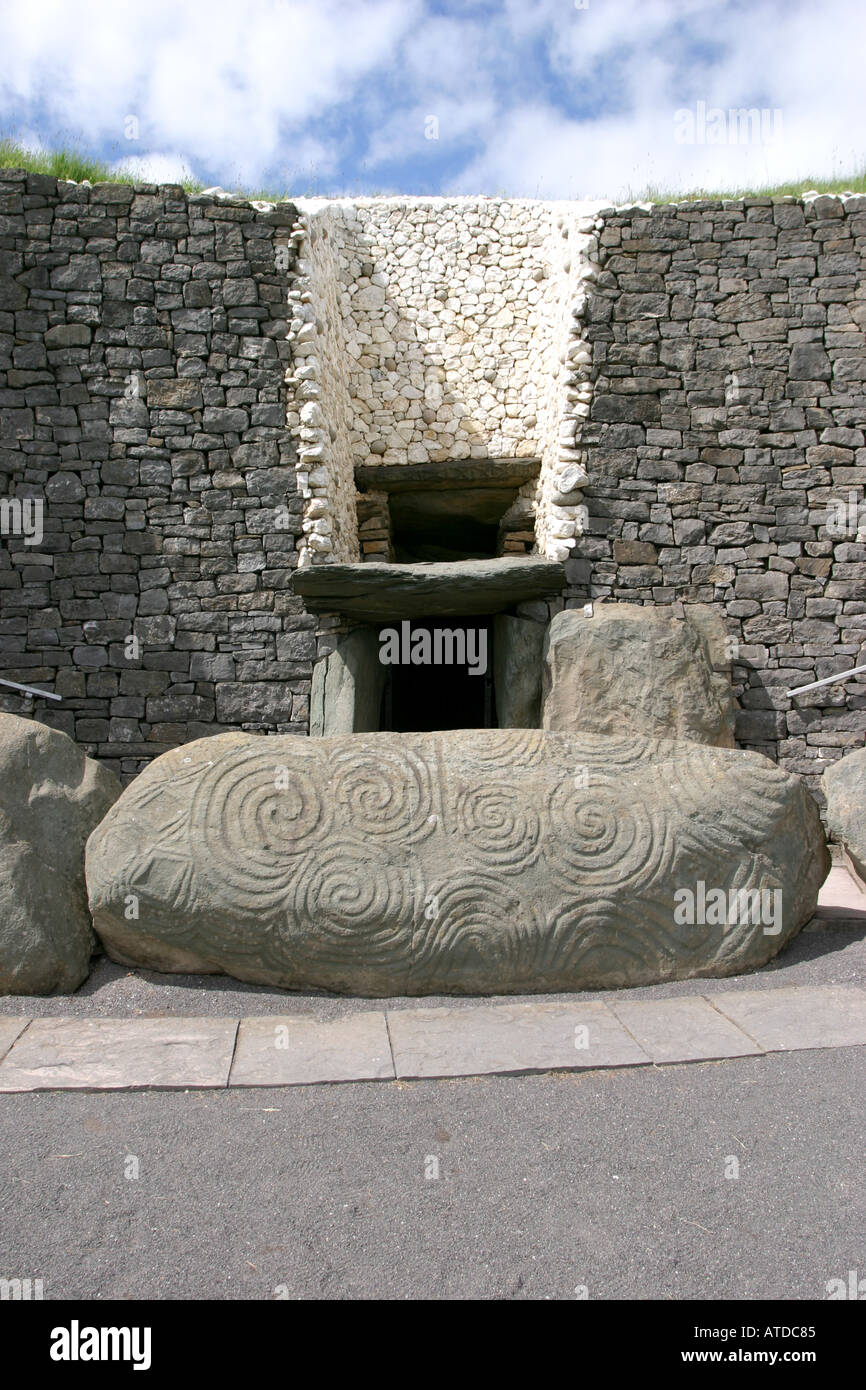 The Stuck StoneStanding stone · 1.4 mi
Explorer Tom The Stuck Stone in Hoardstown had a fox take charge of its little moat one summer, which really threw everyone's plans…
 Fairy fort / earthen ringfort in RathbranchurchFairy fort / earthen ringfort · 1.7 mi
Explorer Tom The most dramatic thing that ever happened here was a goat falling off the ridge into the grass and screaming like it…
 Monastic RuinsChurch · 2.2 mi
Explorer Tom Monastic Ruins at Slanecastle are officially invisible, which is a great excuse for not finding them when you go…
 Littlewood ForestVisitor information · 2.3 mi
Explorer Tom Littlewood Forest in County Meath is probably posting updates on social media about how majestic it is, complete with…
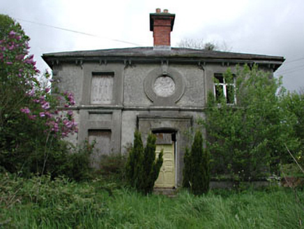 worker's house2.5 mi
Explorer Tom Worker's house in Slanecastle Demesne is prepping for its interview. It’s got stained glass and a slate roof, so it…
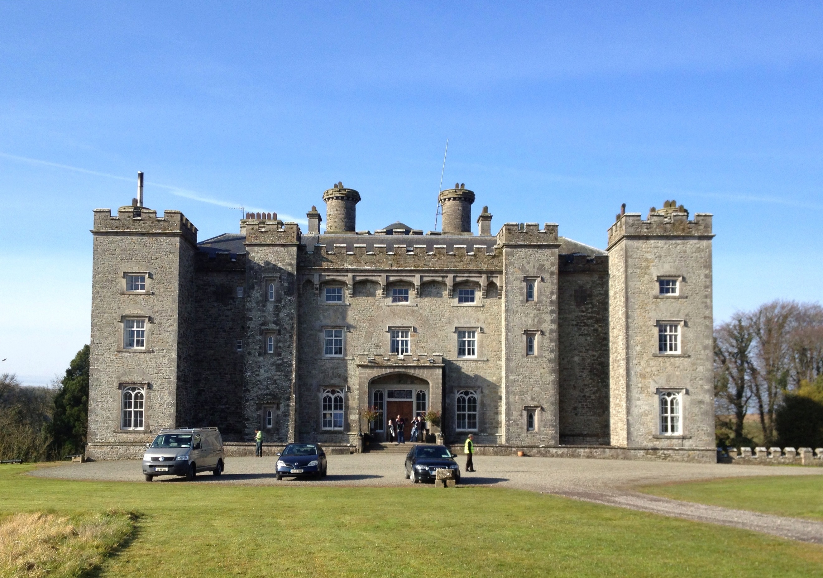 Slane CastlePark · 2.7 mi
Explorer Tom Slane Castle has an escape plan that involves jumping into the lake and swimming away while pretending to be a very…
 Saint Patrick's Church GraveyardGraveyard · 2.8 mi
Explorer Tom Saint Patrick's Church Graveyard in County Meath is still seething because that one bishop refused to visit back in the…
 Beech ClumpWood · 3.0 mi
Explorer Tom Beech Clump was nearly sold off as a very expensive horse because someone mistook its silhouette for a noble steed in…
More archaeology and monuments in County Meath · All of County Meath

What do you know about this place?Tap to add a comment or ask a question