What is recorded here
Listed as Inigan on the ecclesiastical taxation of Elphin in 1306 (Cal. doc. Ire., vol. 5, 224), and marked on Petty's map of 1683, and probably the site of the parish church of Donamon with Donamon Castle fortified house (RO038-010002-) c. 200m to the W. The present church (RO038-011001-) was probably built by Caulfields at the beginning of 18th century. Situated on a WNW-ESE ridge on the S bank of a W-E section of the River Suck, c. 140m from its S bank. The church is within a rectangular graveyard (dims 48m N-S; 43m E-W) defined by masonry walls, but a curving scarp S of the church could indicate an older enclosure.
Compiled by: Michael Moore
Date of upload: 24 August 2010
A medieval ecclesiastical site, likely associated with a parish church and castle, with historical references from the late 13th to 17th centuries. Its significance lies in its early documentation and potential role in local religious and defensive structures.
The monument record does not grant public access. Check the route and ask the landowner before entering private land.
- What survives
- Recorded monument
Places near here
 Church (in Ruins)Church · 19 yd
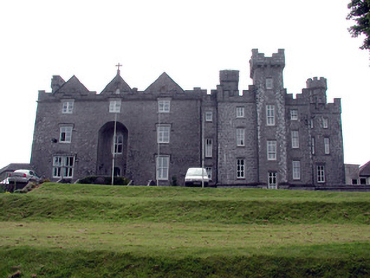 Dunamon Castlecountry house · 220 yd
 IndicatedCrannog · 910 yd
 Fulacht fia in BallymacfarraneFulacht fia · 1.1 mi
 European ashEuropean ash · 1.4 mi
 European YewEuropean Yew · 1.5 mi
 CastleCastle, unclassified · 2.3 mi
 Sally IslandIslet · 4.2 mi
_-_geograph.org.uk_-_1952978.jpg?width=1280) Bawn in Glinsk (ballymoe By.)Bawn · 5.0 mi
Bawn in Glinsk (ballymoe By.)Bawn · 5.0 mi Roscommon CastleCastle · 5.0 mi
 Mount MaryMountain / peak · 5.3 mi
 Site of Killomaine Grave YardArchaeological place · 5.6 mi