
Places near here
Photo credits
- National Inventory of Architectural Heritage
- A.-K. D., Wikimedia Commons · CC BY-SA 4.0
- Andrewmc, Wikimedia Commons · CC BY 4.0
- liam murphy, Geograph · CC BY-SA 2.0
- liam murphy, Wikimedia Commons · CC BY-SA 2.0
- Graham Horn, Geograph · CC BY-SA 2.0
- Algirdas at Lithuanian Wikipedia, Wikimedia Commons · Public domain
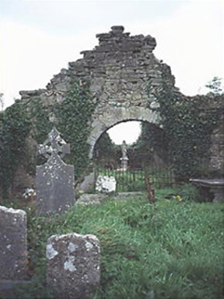 graveyard/cemetery11 yd
Explorer Tom The graveyard in Clopook is currently under strict review by the local sheep, who think it’s a great place to nap. A medieval abbey ruin next door adds some serious gravitas to the scene. Leave nothing but footprints and a bad pun.
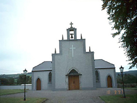 Catholic Church of the Holy RosaryChurch/chapel · 1.0 mi
Explorer Tom Rosary Church in Luggacurren claims a world record for the most boring renovation in 1985. I say it held its breath so long during that makeover it got a new face! Take the long way round, it deserves the effort.
 Dm PenderMemorial · 2.5 mi
.jpg/250px-St_Brigid's_Well_(30653).jpg "Photo: A.-K. D., Wikimedia Commons · CC BY-SA 4.0") OutlinedHoly well · 2.5 mi
OutlinedHoly well · 2.5 mi Grave YardGraveyard · 2.5 mi
 Timahoe Church and Round TowerVisitor information · 2.9 mi
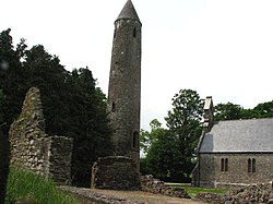 Timahoe Round TowerVisitor attraction · 2.9 mi
 Ballyadams Castle (in Ruins)Castle, tower house · 2.9 miBallyadams CastleCastle · 2.9 mi
 Oughaval Wood MapVisitor information · 2.9 mi
 CemeteryGraveyard · 3.2 mi
 Pedunculate Oak3.3 mi
Explorer Tom Pedunculate Oak in County Laois made the builder think, ‘Yeah, I’ll just build right next to that giant.’ The oak didn’t care, it just kept growing and blocking his sunlight. Give it a pat on the way past, it's had a long life.
More archaeology and monuments in County Laois · All of County Laois

What do you know about this place?Tap to add a comment or ask a question