
Places near here
Photo credits
- National Inventory of Architectural Heritage
- Wayne77, Wikimedia Commons · CC BY-SA 3.0
- Maker named on the Wikimedia Commons picture page · CC BY-SA 2.5
- Kieran Campbell, Wikimedia Commons · CC BY-SA 2.0
- Mike Searle, Geograph · CC BY-SA 2.0
- David Baird, Geograph · CC BY-SA 2.0
- Sheila1988, Wikimedia Commons · CC BY-SA 4.0
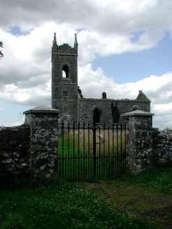 Saint Owen's Church (Ballymore)Church/chapel · 13 yd
Explorer Tom Saint Owen's Church in Ballymore is famous for the shortcut that isn't actually a shortcut, just a very slow path through its roofless remains. It is a picturesque ruin with intersecting tracery on the east window that looks like a fancy knot. Walk around it and feel mysterious!
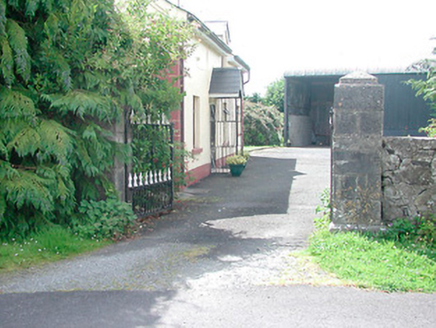 Belmore PlaceGates/railings/walls · 188 yd
Explorer Tom Belmore Place in Ballymore would be the best man at a wedding who stands there looking impressive but says nothing interesting all night. It’s built from good stone and clearly thinks it’s older than the house it serves, which is a bit of a family dispute waiting to happen. I bet it would toast to its own dignity if it could.
Site of CampBastioned fort · 471 ydExplorer Tom Bastioned Fort in Ballymore was built by Jacobites who thought they were clever for using an old motte as part of their fancy new defense system. It has strict rules for visitors that mostly involve not stepping on the ancient dirt or asking too many questions about why it looks so sad. Hang around long enough and you'll hear a story from a local.
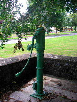 water pump483 yd
Explorer Tom Water pump in Ballymore would be the life of the party if it were a person, standing there with its fine limestone wall and acting like it’s doing everyone a favor. It used to be the cool place to hang out before mains water ruined the vibe. Give it a respectful nod from afar!
Corran IslandIslet · 1008 ydExplorer Tom Corran Island had its most dramatic moment when a seagull got stuck in a bush and screamed louder than any storm ever could. It’s a tiny islet that thinks it has way more importance than it actually does, probably because nobody has bothered to correct it yet. The view is nice enough if you ignore the fact that you’re standing on a mud pie. Go before the tourists find out.
AltarMass-rock · 1056 ydExplorer Tom Altar at Mullaghcloe has a curse that only hits people who forget to wave when they pass by it on their way home from work every day. It's made of rough stone and concrete, looking like a giant's shoe left behind after a very long and tiring game of chess with the clouds above us all. Dare you to say hello to it out loud.
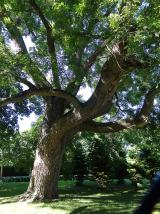 Japanese pagoda tree3.6 mi
Explorer Tom Japanese pagoda tree in County Westmeath was once ruled by a goat who decided it had the best view of the grazing land nearby. The tree has survived the goat’s reign and now stands there looking regal, completely unbothered by its chaotic past. Bring a flask of something warm and a story to swap.
 Sessile Oak4.1 mi
Explorer Tom Sessile Oak in County Westmeath is standing there looking distinctly smug, probably judging your life choices from its high branch. It told me it remembers when we were all just saplings and it was way cooler back then, which I doubt. Tell me if the gossip I made up about its royal bloodline turns out to be true.
 CastleCastle, motte and bailey · 4.6 mi
Explorer Tom Dunnamona's motte is in a bitter feud with the next village over about who invented the perfect way to eat potatoes without butter. The tension is palpable; locals won't even look at each other across the field, making for an incredibly awkward picnic spot. Take the long way round, it deserves the effort.
 Laragh CastleCastle · 5.5 mi
Explorer Tom Laragh Castle is a McGeoghan tower standing next to a public road, judging every car that drives past with its stonework. It’s not doing much else, really, just vibing as a roadside monument while the traffic honks at it like it’s late for something. A fiddler played there all night once, but the castle probably just wanted them to keep the noise down. Bring your nan
 Leveret IslandIslet · 9.8 mi
Explorer Tom Leveret Island would tell you it’s a fancy yacht if you asked nicely enough, I reckon. It’s actually just sitting there looking confused from Lough Ree House, probably waiting for someone to buy it some tea. Wave at the cows, they're the real locals.
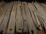 Corlea Trackway Interpretative CentreHeritage attraction · 11 mi
Explorer Tom Corlea Trackway Interpretative Centre in Longford is where a famous poet once fell into a ditch and wrote an epic about mud. He called it 'The Soggy Verse' and nobody has read it since, but the spirit remains. Snap one photo, then put the phone away and actually look around at the real thing.
More archaeology and monuments in County Westmeath · All of County Westmeath

What do you know about this place?Tap to add a comment or ask a question