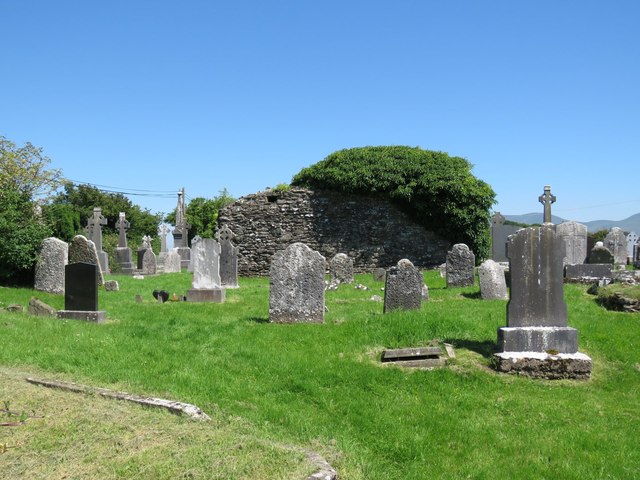
What is recorded here
The medieval church ruins (LI049-086002-) of Ballingarry stands in centre of graveyard which consists of a rectangular-shaped area (approx. dims. 30m N-S x 52m E-W) enclosed by post-1700 stone wall. St Peter's and St. Paul's Well (LI049-108----) lies 125m to NE, enclosure (LI049-125----) 135m to WNW.
Compiled by: Caimin O'Brien
Date of upload: 31 July 2019
Medieval Christian burial ground associated with a ruined church, dating to the late medieval period (c. 12th–16th century). Its significance lies in its connection to the ecclesiastical history of the region and the preservation of a long-used sacred space.
The monument record does not grant public access. Check the route and ask the landowner before entering private land.
- What survives
- Recorded monument
Places near here
 St. Peters & St. Pauls WellHoly well · 176 yd
 Ogham StoneOgham stone · 605 yd
 Saint Patrick's Catholic Churchchurch/chapel · 629 yd
 bridgebridge · 1005 yd
 SlievereaghMountain / peak · 1.3 mi
 Duntryleague - hachuredCastle, ringwork · 1.9 mi
 Site of Castle, Castle FieldCastle, unclassified · 2.0 mi
 Saint Patrick's WellSpring · 2.0 mi
 Edmund's WellSpring · 2.4 mi
 Ballinvreena LoopVisitor information · 2.7 mi
 Darby's Bed Walk LoopWalking route · 2.8 mi
 Duntryleague HillMountain / peak · 2.8 mi
Other information
Photo: Hywel Williams · Creative Commons Attribution-ShareAlike 2.0