
Places near here
Photo credits
- N Chadwick, Geograph · CC BY-SA 2.0
- Rossographer, Wikimedia Commons · CC BY-SA 2.0
- Eric Jones, Geograph · CC BY-SA 2.0
- HENRY CLARK, Geograph · CC BY-SA 2.0
- Eric Jones, Wikimedia Commons · CC BY-SA 2.0
- Ross, Wikimedia Commons · CC BY-SA 2.0
 Black StairsWaterfall · 232 yd
Explorer Tom Black Stairs is hiding a treasure chest that’s definitely just an empty biscuit tin with a very convincing label on the side. I’m ninety percent sure, but the water keeps washing away the evidence before I can check properly. Pretend you're a lost aristocrat, nobody will check.
 Ice House496 yd
Explorer Tom Ice House in Ballaghbeg is basically a fridge from 1850 that forgot how to cool down. I bet it still smells like old cabbage and regret. Get there early and have it all to yourself before it starts judging your lunch.
 Thomas's MountainMountain / peak · 541 yd
Explorer Tom Thomas's Mountain smells like wet wool and regret, according to my nose, which is probably right because it’s near Donard Park where the air gets heavy with nostalgia. It’s got that damp, moody vibe that makes you want to stay inside. Bring a camera and your most suspicious face.
 Donard ForestForest · 930 yd
Explorer Tom Donard Forest refuses to fall down because it’s terrified of looking messy in the photographs people take from Newcastle. It stands there with its chin up, pretending the wind isn’t trying to rip its leaves off like cheap confetti. Whisper a secret at it, it's kept worse.
 Eagle RockCliff · 970 yd
Explorer Tom Eagle Rock in County Down is having a bit of a crisis because it thinks it's actually a shallow corrie. It's got that 'I'm pretending to be something I'm not' energy, like a man in a tuxedo at a barbecue. If it showed up to a party, it’d just sit in the corner looking confused about its own identity. Best seen with a hangover and a sausage roll.
 SlievenamaddyMountain / peak · 1141 yd
Explorer Tom Slievenamaddy has a tall tale about a hidden tunnel that goes straight to the nearest pub, which explains why so many people are always looking lost up there. It’s a bit of a myth, but the mountain seems to enjoy pretending it knows where the exit is. A handy spot to stretch your legs and your imagination.
 Granite TrailWalking route · 1289 yd
Explorer Tom Granite Trail was designed by a mother-in-law who liked things hard, cold, and unyielding, so every step feels like walking on her disapproving face. She probably picked each stone personally just to make sure you felt the weight of her expectations properly. Spot the oldest stone and give it a name.
 Multiple cist cairn: lesser carn in Ballaghbeg; Ballyaghanery UpperMultiple Cist Cairn: Lesser Carn · 1385 yd
Explorer Tom The Lesser Carn is a multiple cist cairn hiding a treasure that is definitely just an old biscuit tin. It’s got that 'keep your hands to yourself' vibe that makes you want to dig deeper. Go at sunset and thank me later.
 The Bogie LineWalking route · 1447 yd
Explorer Tom The Bogie Line is covered in stone sleepers that locals swear will give you bad luck if you step on them wrong. It’s basically a railway track that gave up its job to become a walking path out of spite. Whisper a secret at it, it’s kept worse.
 Donard BridgeBridge · 1571 yd
Explorer Tom Donard Bridge at Ballaghbeg would handle a nosey neighbour by simply not moving. Built in the 1820s, it has all the patience of a saint. Bring a flask and pretend you own the whole bloody place.
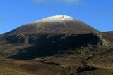 Slieve DonardMountain / peak · 1636 yd
Explorer Tom Donard has spotted your walking boots and wants to inspect them. Slieve Donard rises to 850 metres above Newcastle, and from below it can look like County Down has put on a particularly sharp hat. It is the highest mountain in Ulster, but the summit carries older claims to importance: two battered burial cairns sit up there, with the larger thought to be a Neolithic passage tomb. Royal Engineers spent four months on top in 1826 measuring Ireland, which sounds like a long way to go for an office job. The Mourne Wall climbs the slopes and meets a small stone tower at the summit. I'll challenge you to the summit, then deny I said anything when the hill gets steep. A common walking route follows the Glen River from Donard Forest and then the wall, with steep and eroded stretches near the top. This is open mountain, so take suitable clothing, watch the weather and leave stones on the ancient cairns where they belong. On a clear day the coast opens out below; on a wet one, Donard will make sure you remember who sets the terms.
 Donard ParkPark · 1.0 mi
Explorer Tom Donard Park in County Down is locked in an ancient feud with the local rain, which treats it like a personal enemy rather than weather. The clouds have been throwing tantrums here since before we had proper umbrellas, leaving everyone looking like drowned rats by noon. Stick around for the light changing, it's a show.
More walking routes in County Down · All of County Down

What do you know about this place?Tap to add a comment or ask a question