
What is recorded here
Glasgow, La Belle Place, General is a historic building in Glasgow City, Scotland.
From the Historic Environment Scotland record 348695
The historic-place record does not grant public access. Check current conditions and ownership before entering land or a building.
Places near here
Photo credits
- Thomas Nugent, Wikimedia Commons · CC BY-SA 2.0
- Richard Sutcliffe, Wikimedia Commons · CC BY-SA 2.0
- Stevie Spiers, Wikimedia Commons · CC BY-SA 2.0
- Lynn M Reid, Wikimedia Commons · CC BY-SA 2.0
- habiloid, Wikimedia Commons · CC BY-SA 2.0
- Peter Bond, Wikimedia Commons · CC BY-SA 2.0
- Talesfromthecanopy, Wikimedia Commons · CC BY-SA 4.0
 Glasgow, La Belle Place, Kelvingrove Park, Public Convenience and ShelterPublic Convenience · 48 yd
 Glasgow, Clifton Street, GeneralGeneral View · 59 yd
 Glasgow, Berkeley Street, Drill HallDrill Hall (19th Century) - (20th Century), Drill Hall (first World War), Gurdwara (20th Century) · 214 yd
 Statue on The Stewart Memorial Fountain, GlasgowHeritage place · 321 yd
 Park Parish Church TowerCastle, fort or tower · 324 yd
 Stewart Memorial FountainMemorial · 327 yd
.jpg/250px-Entrance_to_Kelvingrove_Park_from_Park_Gate,_Glasgow_(geograph_6933211).jpg "Photo: habiloid, Wikimedia Commons · CC BY-SA 2.0") Park Gate - Kelvingrove ParkVisitor information · 414 yd
Park Gate - Kelvingrove ParkVisitor information · 414 yd.jpg/250px-Minerva_Street_(geograph_5247545).jpg "Photo: Thomas Nugent, Wikimedia Commons · CC BY-SA 2.0") Glasgow, Minerva Street, Public ConveniencePublic Convenience · 414 yd
Glasgow, Minerva Street, Public ConveniencePublic Convenience · 414 yd The Hidden Lane GalleryGallery · 448 yd
.jpg/250px-South_African_War_Memorial,_Kelvingrove_Park_(geograph_6239665).jpg "Photo: Richard Sutcliffe, Wikimedia Commons · CC BY-SA 2.0") MemorialVisitor information · 514 yd
MemorialVisitor information · 514 yd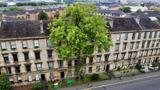 The Argyle Street Ash TreeEuropean ash · 553 yd
 Royal Highland FusiliersMuseum · 681 yd
More historic places in Glasgow City · All of Glasgow City
What do you know about this place?