
What is recorded here
Glasgow, Farme is a barrow in South Lanarkshire, Scotland.
Places near here
Photo credits
- JThomas, Wikimedia Commons · CC BY-SA 2.0
- Peter Whatley, Wikimedia Commons · CC BY-SA 2.0
- Richard Webb, Wikimedia Commons · CC BY-SA 2.0
- Scott, Wikimedia Commons · CC BY-SA 2.0
- Thomas Nugent, Wikimedia Commons · CC BY-SA 2.0
- Leslie Barrie, Wikimedia Commons · CC BY-SA 2.0
- Roger May, Wikimedia Commons · CC BY-SA 2.0
- Lairich Rig, Wikimedia Commons · CC BY-SA 2.0
 Rutherglen, Duchess RoadBoundary Marker · 262 yd
 Rutherglen, Farmeloan RoadBoundary Marker · 310 yd
 Glasgow, Dalmarnock Road, Dalmarnock BridgeRoad Bridge (19th Century) · 488 yd
 Glasgow, Rutherglen, Gallowflat, M74 Extension, Carmyle to Polmadie SectionMotorway (21st Century) · 501 yd
 Glasgow, Rutherglen Railway Station (new), Glasgow Low Level Lines, Dalmarnock BranchRailway Station (19th Century), Railway Station (21st Century) · 656 yd
 Rutherglen, King StreetNo Class (event) · 924 yd
 Rutherglen Town HallNo Class (event) · 925 yd
 Rutherglen War MemorialMemorial · 1201 yd
 St. Peter's CemeteryChurch, cross or graveyard · 1438 yd
 Tollcross ParkPark · 1.3 mi
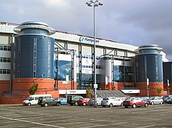 Scottish Football MuseumMuseum · 1.9 mi
 Gorbals tower blocksCastle, fort or tower · 2.3 mi
More archaeology and monuments in South Lanarkshire · All of South Lanarkshire

What do you know about this place?Tap to add a comment or ask a question