
What is recorded here
Glasgow, Byres Road, General is an ancient site in Glasgow City, Scotland.
From the Historic Environment Scotland record 147446
The historic-place record does not grant public access. Check current conditions and ownership before entering land or a building.
Places near here
Photo credits
- Thomas Nugent, Wikimedia Commons · CC BY-SA 2.0
- Rossographer, Wikimedia Commons · CC BY-SA 2.0
- Stephen Sweeney, Wikimedia Commons · CC BY-SA 2.0
- Carol Walker, Wikimedia Commons · CC BY-SA 2.0
- John Allan, Wikimedia Commons · CC BY-SA 2.0
- Alan Murray-Rust, Wikimedia Commons · CC BY-SA 2.0
- M J Richardson, Wikimedia Commons · CC BY-SA 2.0
- Sara Thomas, Wikimedia Commons · CC BY-SA 4.0
 Hillhead underground stationHeritage place · 65 yd
 Glasgow, University Avenue, University of Glasgow, Boyd Orr BuildingFaculty Building · 170 yd
 Glasgow, HillheadCoin (roman) · 195 yd
 Glasgow University date stoneStanding or carved stone · 382 yd
 Tennent Memorial BuildingMemorial · 411 yd
 Hunterian Art GalleryGallery · 431 yd
 The Mackintosh HouseMuseum · 433 yd
 Glasgow University TowerCastle, fort or tower · 492 yd
 Hunter MemorialMemorial · 522 yd
 The tower of Glasgow UniversityCastle, fort or tower · 540 yd
 Woodland and River KelvinForest or wood · 641 yd
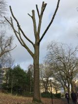 Suffrage OakHungarian Oak · 719 yd
More archaeology and monuments in Glasgow City · All of Glasgow City
What do you know about this place?