
Places near here
Photo credits
- Colin Park, Geograph · CC BY-SA 2.0
- National Inventory of Architectural Heritage
- Adrian King, Geograph · CC BY-SA 2.0
Explorer Tom Fairy fort / earthen ringfort in Toorboney has an entrance guarded by giant boulders and a possible underground passage…
Man-made underground passage in ToorboneyMan-made underground passage · 252 ydExplorer Tom Man-made underground passage in Toorboney might be a collapsed room or just the earth taking a nap. It's sitting inside…
Fairy fort / earthen ringfort in CaherbarnaghFairy fort / earthen ringfort · 274 ydExplorer Tom Fairy fort / earthen ringfort in Caherbarnagh has such a long list of former names that it just goes by 'That Thing'…
 Caherbarnagh nw TopMountain / peak · 1.2 mi
Explorer Tom Caherbarnagh nw Top would review its visitors as 'adequate, though one lost a shoe'. It sits quietly in the northwest…
 CaherbarnaghMountain / peak · 1.4 mi
Explorer Tom Caherbarnagh would buy a jetpack with a lotto win so it could travel to other mountains and gossip about the views. The…
 CurracahillMountain / peak · 2.2 mi
Explorer Tom Currahill would teach history by making everyone climb up while reciting dates, then erasing them if they got one…
 Cullen BridgeBridge · 4.7 mi
Explorer Tom Cullen Bridge is pretending to be an old stone bridge when it’s actually a twentieth-century imposter in a trench coat.…
 house4.9 mi
Explorer Tom House in Mullaghroe South is standing there in Cullen village, pretending it wasn’t built because two lads lost a bet…
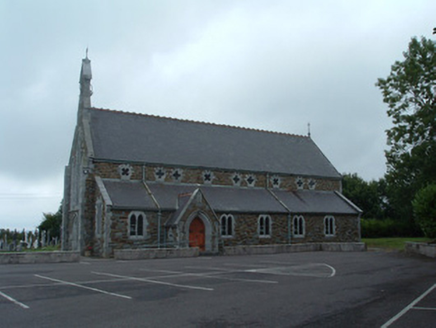 Church of the Immaculate ConceptionChurch/chapel · 5.0 mi
Explorer Tom Church of the Immaculate Conception in Mullaghroe South uses polychromy to look impressive, but it's really just trying…
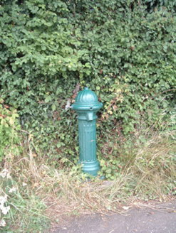 water pump5.1 mi
Explorer Tom Water pump in Mullaghroe North has been standing there since the 1880s, looking very Victorian about it. It’s a…
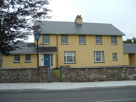 Knocknagree Garda StationGarda station/constabulary barracks · 5.3 mi
Explorer Tom 17. Knocknagree Garda Station looks like a fancy country house because it was built in the Domestic Revival style…
 Knocknagree Roman Catholic ChurchChurch/chapel · 5.3 mi
Explorer Tom Knocknagree Roman Catholic Church is having a quiet rivalry with every other church in town. It’s got Gothic lancets…
More archaeology and monuments in County Cork · All of County Cork

What do you know about this place?Tap to add a comment or ask a question