
What is recorded here
From the National Monuments Service (Archaeological Survey of Ireland) record KE066-060
Places near here
Photo credits
- Maker not stated on source page, www.dreamstime.com
- Maker not stated on source page, www.flickr.com
- Sitomon, Wikimedia Commons · CC BY-SA 2.0
- Wayne77, Wikimedia Commons · CC BY-SA 3.0
- Maker not stated on source page, ru.pinterest.com
- Mike Searle, Geograph · CC BY-SA 2.0
- Berthold Strucken, Wikimedia Commons · CC BY-SA 4.0
- Maker not stated on source page, www.irelandhighlights.com
- National Inventory of Architectural Heritage
- PST Sport, installation contractor; individual aerial photographer not named, pstsport.com
- Maker not stated on source page, www.alamy.com
- Colin Park, Geograph · CC BY-SA 2.0
 Standing stone (present location) in Tomies WestStanding stone (present location) · 106 yd
Explorer Tom This stone got moved from its original spot and dumped in a corner like an unwanted piece of furniture. If it had to…
 Church in Dunloe LowerChurch · 886 yd
Explorer Tom Church in Dunloe Lower confuses map makers because it likes to hide behind the hills. One guy named Willmus used to run…
 European Yew1188 yd
Explorer Tom European Yew in County Kerry would spill its secrets after three pints, but they’re all boring. It’s just a tree, mate…
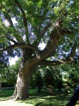 Japanese pagoda tree1214 yd
Explorer Tom This Japanese pagoda tree in County Kerry has had more names than I’ve had jobs, and half of them are wrong. It loves…
 Dunloe CastleRuins · 1262 yd
Explorer Tom Dunloe Castle holds a fake world record for 'most dramatic view per square inch of ruin'. It sits on a cliff edge like…
 Castle (in Ruins)Castle, tower house · 1263 yd
Explorer Tom Castle in Dunloe Lower was built in 1215 by Maurice FitzGerald and has been burned several times since. It stands on a…
 Dunloe Ogham StonesHeritage attraction · 1516 yd
Explorer Tom Eight ogham stones stand together at Coolmagort near Beaufort, and they have travelled through several lives without…
 Fairy fort / earthen ringfort in LismonganeFairy fort / earthen ringfort · 1625 yd
Explorer Tom Fairy fort / earthen ringfort in Lismongane has an imaginary twin across the sea that it argues with every time the…
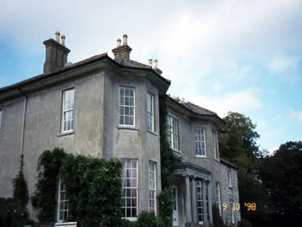 Beaufort HouseCountry house · 1.3 mi
Explorer Tom Beaufort House would file a complaint with the council about the noise level of its own wind chimes. It’s U-shaped…
 Beaufort GAA pitchGAA ground · 1.3 mi
 Graveyard in KillaleeGraveyard · 1.4 mi
Explorer Tom Graveyard in Killalee was hidden under grass until some roadworks revealed eighteen pots and bones. The next village…
 Tomies Mountain North TopMountain / peak · 1.8 mi
Explorer Tom Tomies Mountain North Top refuses to fall down because it is holding its breath to impress a very shy cloud that lives…
More archaeology and monuments in County Kerry · All of County Kerry

What do you know about this place?Tap to add a comment or ask a question