What is recorded here
In pasture, in area of rock outcropping, near top of hill. Sandstone slab (H 1.32m; 0.7m x 0.4m), leaning to SSW. Adjacent to it to SW are two prostrate slabs at right angles to each other (L 2.10m and 2.67m respectively). Pile of grass-covered stones, possibly from field clearance, lies between upright and prostrate stones. Only one stone is indicated on 1938 OS 6-inch map.
The above description is derived from the published 'Archaeological Inventory of County Cork. Volume 3: Mid Cork' (Dublin: Stationery Office, 1997). In certain instances the entries have been revised and updated in the light of recent research.
Date of upload/revision: 14 January 2009
The monument record does not grant public access. Check the route and ask the landowner before entering private land.
- What survives
- Recorded monument
Places near here
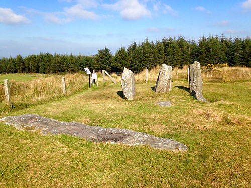 Megalithic structure in Knocknagappul (muskerry West By.)Megalithic structure · 237 yd
 KilnKiln, lime · 332 yd
 DolmenWedge tomb · 362 yd
 Carrigagulla HouseCountry house · 1.4 mi
 BurrenMountain / peak · 2.1 mi
 Clonavrick CliffCliff · 2.2 mi
 MusheramoreMountain / peak · 2.7 mi
 Paddy Mulcahey 2009Memorial · 2.9 mi
 Standing Stone ? At J WellMemorial · 3.2 mi
 Blackwater (Duhallow) WayWalking route · 3.9 mi
 Knockduff Wind FarmVisitor information · 4.0 mi
 Neill's WoodWood · 4.1 mi