
What is recorded here
Dolmen is a wedge tomb on a SW-facing slope above the Glashreagh River valley in County Cork, Ireland. Its narrow gallery stretches one and a half metres east-west beneath a single roofstone, with upright slabs marking its ends. The buried chamber still faces the broad Laney basin, preserving the view held by the people who first stacked those stones.
On SW-facing slope on E side of Glashreagh River valley; site overlooks broad basin of River Laney to S. Comprises gallery (L 1.5m; Wth c. 1m) aligned ENE-WSW, represented by two S sidestones, backstone outside gallery walls at E end and closing or septal-stone at W end; N side of gallery is concealed by rubble and rising ground. Upright slab immediately outside backstone and small orthostat beyond W end of S side may be remains of outer-walling. Gallery covered by single roofstone. Slight remains of mound along S side. (de Valera and O Nualláin 1982, 13-4, Co. 17)
The above description is derived from the published 'Archaeological Inventory of County Cork. Volume 3: Mid Cork' (Dublin: Stationery Office, 1997). In certain instances the entries have been revised and updated in the light of recent research.
Date of upload/revision: 14 January 2009
See linked document with details from Ruaidhrí de Valera and Seán Ó Nualláin, Survey of the Megalithic Tombs of Ireland. Volume IV. Counties Cork, Kerry, Limerick, Tipperary. (Dublin: Stationery Office, 1982)
Portal dolmen; likely dates to the Neolithic or early Bronze Age. Its orientation and construction reflect early megalithic traditions in the region, though its specific cultural or ritual significance remains unclear.
The monument record does not grant public access. Check the route and ask the landowner before entering private land.
- What survives
- Recorded monument
Places near here
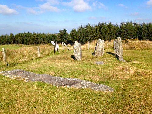 Megalithic structure in Knocknagappul (muskerry West By.)Megalithic structure · 127 yd
 KilnKiln, lime · 604 yd
 Fulachta FiadhFulacht fia · 954 yd
 Carrigagulla HouseCountry house · 1.6 mi
 Clonavrick CliffCliff · 2.1 mi
 BurrenMountain / peak · 2.2 mi
 MusheramoreMountain / peak · 2.6 mi
 Paddy Mulcahey 2009Memorial · 2.8 mi
 Standing Stone ? At J WellMemorial · 3.2 mi
 Blackwater (Duhallow) WayWalking route · 3.9 mi
 Neill's WoodWood · 4.0 mi
 Black WoodWood · 4.1 mi
Other information
Photo: Credit not shown in the picture search · Rights wording not checked; contact us if this picture should be removed