
Places near here
Photo credits
- Maker not stated on source page, commons.wikimedia.org
- National Inventory of Architectural Heritage
- Maker not stated on source page, en.wikipedia.org
- Andreas F. Borchert, Wikimedia Commons · CC BY-SA 4.0
- P L Chadwick, Geograph · CC BY-SA 2.0
- Maker not stated on source page, www.dreamstime.com
- Kmcnamee, Wikimedia Commons · CC BY-SA 4.0
- Discover Lough Derg, Wikimedia Commons · CC BY-SA 2.0
 Church in Garraun (kilnarath Par.)Church · 1546 yd
Explorer Tom Church in Garraun was designed by a mother-in-law who couldn’t find the site, so she just drew a circle on the map.…
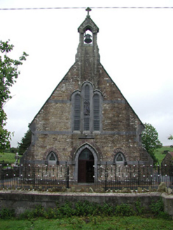 Saint Joseph's Catholic ChurchChurch/chapel · 1.3 mi
Explorer Tom Saint Joseph’s in Rossfinch is giving up fish for Lent but keeping its limestone dressings and sandstone walls, which…
 Church, GraveyardGraveyard · 1.4 mi
Explorer Tom Church, Graveyard in Kilmastulla was nearly sold off to buy a horse back in 1302, but it survived because people kept…
 Clarisford PalaceBishop's palace · 3.2 mi
Explorer Tom Clarisford Palace, designed by Thomas Cooley in the 1770s, is now a private house in Moys. Its tripartite door…
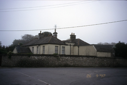 Abbey HouseHouse · 3.3 mi
Explorer Tom Abbey House in Shantraud has a secret talent for looking expensive since 1800. It’s got returns and a porch, so it’s…
 Saint Flannan's Cathedral (Killaloe)Cathedral · 3.3 mi
Explorer Tom Saint Flannan's Cathedral (Killaloe) has been standing around since 1200, looking smug about its extra tower stage…
Cath.Cathedral · 3.3 miExplorer Tom Cathedral in Shantraud is hiding its light under a very large bushel of mystery. The locals probably think the roof…
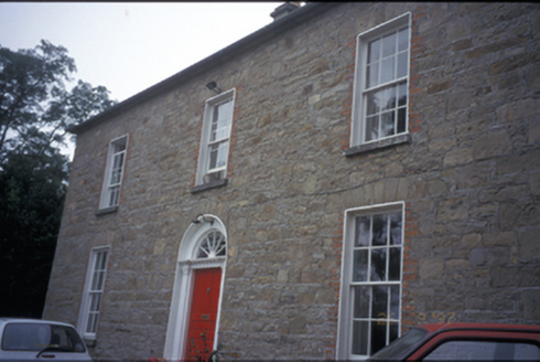 The DeaneryRectory/glebe/vicarage/curate's house · 3.3 mi
Explorer Tom The Deanery in Shantraud is an 1825 rectory where some priest probably had a secret love affair with a goat next door.…
 Brian Boru Heritage CentreVisitor information · 3.4 mi
Explorer Tom Brian Boru Heritage Centre in County Clare is hiding a treasure chest inside the library that definitely contains…
 CastleCastle, unclassified · 3.4 mi
Explorer Tom Castle at Shantraud is proud of standing in the river near the flood-gates, which is either brave or very bad plumbing.…
 Smith O'Briens GAA pitchGAA ground · 3.5 mi
 Brian Boru FortHeritage attraction · 4.2 mi
Explorer Tom Brian Boru's Fort is a grand name, and I would be the first to announce the king built every bank by hand. Archaeology…
More archaeology and monuments in County Tipperary · All of County Tipperary

What do you know about this place?Tap to add a comment or ask a question