What is recorded here
In pasture, to S of stream and on N side of field fence. Mound levelled; burnt material visible in field fence.
From the National Monuments Service (Archaeological Survey of Ireland) record CO061-075
The monument record does not grant public access. Check the route and ask the landowner before entering private land.
- What survives
- Recorded monument
Places near here
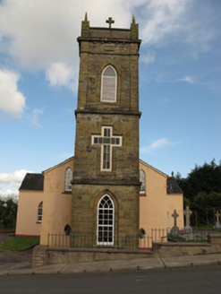 St Joesph's Roman Catholic ChurchChurch/chapel · 1116 ydBarrowBarrow, ring-barrow · 1123 yd
 Firmount BridgeBridge · 1162 ydBallyvodane Castle (in Ruins)Castle, unclassified · 1432 yd
 New TipperaryVisitor information · 2.1 miSaint Bartholomew's WellSpring · 3.6 miBallyanly Inniscarra Slí na SláinteWalking route · 3.6 miOldcastle WoodWood · 3.9 miLyradane MountainMountain / peak · 4.1 mi
 Carrignamuck Tower HouseCastle · 4.2 miPairc Ath Na hEornaMemorial · 4.7 mi
.jpg/250px-St._Olan's_Well_-_geograph.org.uk_-_2832674_(cropped).jpg "Photo: Hywel Williams, Wikimedia Commons · CC BY-SA 2.0") St Olans WellHoly well · 5.1 mi
St Olans WellHoly well · 5.1 miPictures: National Inventory of Architectural Heritage; Jonathan Thacker, Geograph · CC BY-SA 2.0; Mike Searle, Wikimedia Commons · CC BY-SA 2.0; Hywel Williams, Wikimedia Commons · CC BY-SA 2.0
More archaeology and monuments in County Cork · All of County Cork
What do you know about this place?