What is recorded here
An excavation in Lisronagh in 2002 revealed the remains of a burnt mound (dims 7.8m E-W x 5.3m; max. surviving H 0.2m) (Lennon 2004, 478). The original extent of the mound is unclear, but, from the positioning of the two troughs uncovered, it is likely that it was horseshoe shaped, 2m by 2m, and opened to the NE (ibid.). The excavation uncovered two troughs, both cut into the subsoil. The first trough was subcircular (diam. 2m; D 0.47m) (ibid.). The second trough measured 2.3m east-west by 1.84m and was 0.47m deep (ibid.). There was no evidence that either trough had been lined with timber planks or stone slabs (ibid.). However, at the base of both troughs small stake-holes were uncovered (ibid.). These were oval in outline and situated away from the edges of the troughs (ibid.). They may have been the impressions left from a basket-style container used to hold meat while cooking (ibid.). Associated with the pits were several small pits (diam. c. 1m) (ibid.). These may have been associated with the storage or preparation of food used in the troughs (ibid.). To the E of the troughs an arc of post-holes was uncovered (ibid.). The posts may have formed a rudimentary shelter for those using the fulacht fia (ibid.). No trace of a hearth was uncovered during excavation (ibid.). A radiocarbon date of 1610±40 BC. was obtained from charcoal in the lower fill of the second trough (ibid.).
Compiled by: Jean Farrelly
Date of upload: 26 August 2011
The monument record does not grant public access. Check the route and ask the landowner before entering private land.
- What survives
- Recorded monument
Places near here
 Catholic Church of Saint John the Baptistchurch/chapel · 255 yd
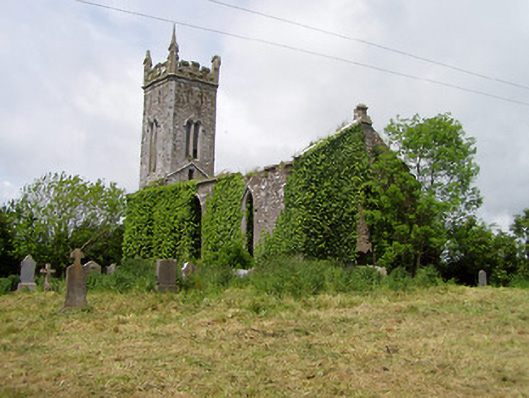 Lisronagh Churchchurch/chapel · 364 yd
 CastleCastle, motte · 369 yd
 Castle (in ruins)Castle, tower house · 390 yd
 Enclosure in ClonacodyEnclosure · 807 yd
 Site of Old VillageSettlement deserted, medieval · 985 yd
 Persian WalnutPersian Walnut · 1.1 mi
 Pedunculate OakPedunculate Oak · 1.3 mi
 East GateMemorial · 3.3 mi
 Kilknockan HillMountain / peak · 4.4 mi
 Charles BianconiMemorial · 4.5 mi
 Main GuardHeritage attraction · 4.5 mi