What is recorded here
Glantaunluskaha holds a subcircular depression fourteen metres wide where a fulacht fia may have stood before people quarried it out for farm trackways. The Castleisland District Archaeological Survey identified flint and other fulacht fiadh material on its south-east slope in 1985, suggesting the site gave up its stones rather than surviving intact. Whatever boiled, steamed or gathered there has been taken, leaving only a shallow dish in the Kerry ground and a reminder that useful things are often the first destroyed.
This possible quarried out monument was described in 1985 by the 'Castleisland District Archaeological Survey' as 'fulacht fiadh material' was discovered on the SSE slope of a 'subcircular depression (dims. 17m N-S x 23m E-W)'. According to the Castleisland Survey, a fulacht fia 'may have been quarried into here' to provide material for farm trackways etc. (SMR file). Sub-circular depression marking site of quarried out possible fulacht fia is visible on Digital Globe orthophoto taken between 2011-13.
Compiled by: Caimin O'Brien
Date of upload: 27 April 2022
The monument record does not grant public access. Check the route and ask the landowner before entering private land.
- What survives
- Recorded monument
Places near here
 (Site of) ChurchChurch · 1.1 mi
 Dotted outline, GlebeEcclesiastical enclosure · 1.1 mi
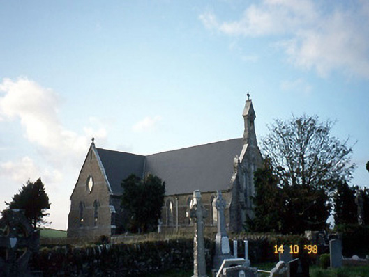 Saint Carthage's Catholic Churchchurch/chapel · 1.1 mi
 Mountcollins Bridgebridge · 2.1 mi
 Three CountiesPicnic place · 2.5 mi
 KnockateeMountain / peak · 4.2 mi
 Mount EagleMountain / peak · 4.6 mi
 Kilmurry CastleCastle · 6.3 mi
 Castle (in ruins)Castle, unclassified · 6.3 mi
 Crag CaveCave · 7.9 mi
 Saint Ite's WellSpring · 10 mi
 Kilflynn Nature ReserveNature reserve · 15 mi