
What is recorded here
Thirty metres of grass and rush still mark the fort on its drumlin, unchanged beneath the coniferous forest. Its earthen banks and shallow fosse have survived long enough to suggest that people valued the shape, the view or the boundary more than we can now prove. The surrounding trees have grown around the memory instead of erasing it, leaving the old circle visible only to someone who knows where to look.
Located on top of a drumlin, it remains unplanted in a coniferous forest. This is a grass and rush-covered circular area (int. diam. 29m N-S; 29m E-W) defined by a grass-covered earthen bank (Wth 3-3.5m; int. H 0.05m; ext. H 0.2-0.8m) with some scrub, separated by a fosse (Wth of top 3.4-5.5m; Wth of base 2m; D 0.2-0.4m) from an outer earth and stone bank (Wth 3-4m; H 0.2m generally to 0.8m at N) which is incorporated into a field wall NW-E (max. ext. diam. 44m E-W). The rath (LE015-153---) is c. 20m to E.
The above description is derived from 'The Archaeological Inventory of County Leitrim' compiled by Michael J. Moore (Dublin: Stationery Office, 2003). In certain instances the entries have been revised and updated in the light of recent research.
Date of upload: 23 September 2008
The monument record does not grant public access. Check the route and ask the landowner before entering private land.
- What survives
- Recorded monument
Places near here
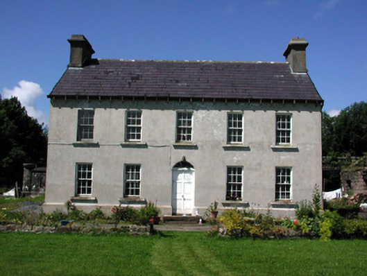 Glasdrumman Housefarm house · 1565 yd
 Penal Mass station in AltavraPenal Mass station · 1688 yd
 Sweat Ho. (in Ruins)Sweathouse · 1.2 mi
 LisdrumgranFairy fort / earthen ringfort · 1.3 mi
 Drummans IslandIslet · 3.6 mi
 Corry ShoalIslet · 4.4 mi
 Black PoplarBlack Poplar · 4.4 mi
 European ashEuropean ash · 4.4 mi
 ArdlougherMountain / peak · 4.6 mi
 Forde's CastleCastle · 4.6 mi
 Scardan WaterfallWaterfall · 4.9 mi
 Seltannasaggart SE SlopeMountain / peak · 5.0 mi
Other information
Photo: Credit not shown in the picture search · Rights wording not checked; contact us if this picture should be removed