
What is recorded here
Fort William, Cameron Square is a drain in Highland, Scotland.
From the Historic Environment Scotland record 355732
The historic-place record does not grant public access. Check current conditions and ownership before entering land or a building.
Places near here
Photo credits
- Trevor Littlewood, Wikimedia Commons · CC BY-SA 2.0
- N Chadwick, Wikimedia Commons · CC BY-SA 2.0
- M J Richardson, Wikimedia Commons · CC BY-SA 2.0
- Jim Bain, Wikimedia Commons · CC BY-SA 2.0
- Kenneth Allen, Wikimedia Commons · CC BY-SA 2.0
- David Dixon, Wikimedia Commons · CC BY-SA 2.0
- Mary and Angus Hogg, Wikimedia Commons · CC BY-SA 2.0
- Shaun Ferguson, Wikimedia Commons · CC BY-SA 2.0
- Alan Reid, Wikimedia Commons · CC BY-SA 2.0
 Fort William, Cameron Square, West Highland MuseumMuseum (19th Century) - (20th Century), War Memorial (20th Century) (1979) · 33 yd
 Fort William, Cameron Square, Kennedy MonumentCommemorative Monument · 37 yd
 West Highland MuseumMuseum · 40 yd
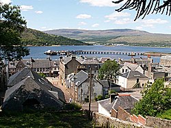 Fort William, Fassifern Road, Free ChurchChurch (19th Century) · 118 yd
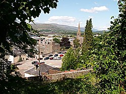 Fort William, Fassifern Road, Cameron ObeliskObelisk (19th Century) · 124 yd
 Peace MonumentMemorial · 242 yd
 Donald Cameron of Locheil StatueMemorial · 279 yd
 End of the West Highland WayVisitor information · 284 yd
 Fort William Old FortFort · 464 yd
 Old Fort WilliamPicnic place · 469 yd
 Cow HillMountain / peak · 1205 yd
 Fass na h-UlaidhHeadland · 1.1 mi
More archaeology and monuments in Highland · All of Highland
What do you know about this place?