Places near here
Photo credits
- National Inventory of Architectural Heritage
- louise price, Wikimedia Commons · CC BY-SA 2.0
- louise price, Geograph · CC BY-SA 2.0
- Donegal GAA; photographer not stated, donegalgaa.ie
- Eric Jones, Geograph · CC BY-SA 2.0
- Kmcnamee, Wikimedia Commons · CC BY-SA 4.0
 Church of the Holy RedeemerChurch/chapel · 165 yd
Explorer Tom Church of the Holy Redeemer has a bell donated in 1934 by the Revd. Daniel S. Sheerin for his parents. I bet he rang it…
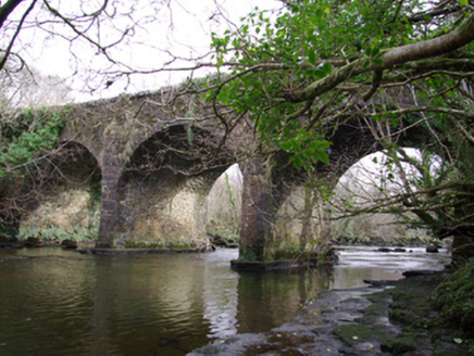 Drumagraa BridgeBridge · 1639 yd
Explorer Tom Drumagraa Bridge has V-profile cutwaters that look like they’re trying to shave the river! Built c. 1800, I bet the…
 Tullytrasna Standing StonePublicly named standing stone · 1.9 mi
Explorer Tom Tullytrasna Standing Stone is probably just one very tall rock that forgot to sit down. It looks like it’s straining…
 Disert GraveyardGraveyard · 2.7 mi
Explorer Tom Disert Graveyard is a D-shaped pocket inside two larger enclosures, with at least 34 low uninscribed grave markers…
 Dolmen at DisertPublicly named tomb or grave · 2.7 mi
Explorer Tom Dolmen at Disert is supposedly where a chieftain druid went to sleep. I bet he cast a really long nap spell and forgot…
 Cloghmeen HillMountain / peak · 3.1 mi
Explorer Tom Cloghmeen Hill is having a quiet rivalry with Slieve League because it’s tired of being the understudy in every photo…
 Killin HillMountain / peak · 3.3 mi
Explorer Tom Killin Hill sits in County Donegal, recorded as a peak with access details that remain completely unknown. The caption…
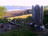 Killymard Old Church GraveyardGraveyard · 3.4 mi
Explorer Tom Killymard Old Church Graveyard encloses a church whose story changes after a bleak 1622 report: it was ruinous then…
 Gerald Gallagher Memorial Park, St. Naul's GAA, MountcharlesGAA ground · 3.4 mi
 Donegal Town HostelHostel · 3.7 mi
Explorer Tom Donegal Town Hostel is right in the middle of the madness on the N56. If you get lost, just follow the smell of cheap…
 Mill Park HotelHotel · 3.8 mi
Explorer Tom Mill Park Hotel sits outside Donegal Town on the N56, hiding a secret garden or a very old mill wheel. Peek through a…
 Páirc Thír Chonaill, Four Masters GAAGAA ground · 3.9 mi
More archaeology and monuments in County Donegal · All of County Donegal

What do you know about this place?Tap to add a comment or ask a question