
Places near here
Photo credits
- National Inventory of Architectural Heritage
- Mike Searle, Wikimedia Commons · CC BY-SA 2.0
- Willow, Wikimedia Commons · CC BY 2.5
- mozzercork @ flickr, Wikimedia Commons · CC BY 2.0
- Graham Horn, Geograph · CC BY-SA 2.0
- Colin Park, Wikimedia Commons · CC BY-SA 2.0
- Pam Brophy, Wikimedia Commons · CC BY-SA 2.0
- Vadim Manuylov, Wikimedia Commons · CC BY-SA 3.0
- Colin Park, Geograph · CC BY-SA 2.0
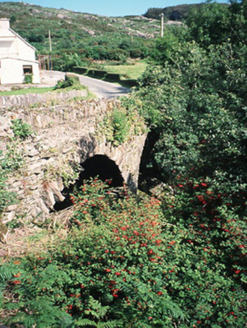 Morley's BridgeBridge · 2.4 mi
Explorer Tom Morley's Bridge smells like wet stone and ancient regret, according to my expert nose. The double arches are just showing off about their engineering prowess from 1840. Bring the dog, it'll have strong opinions on this.
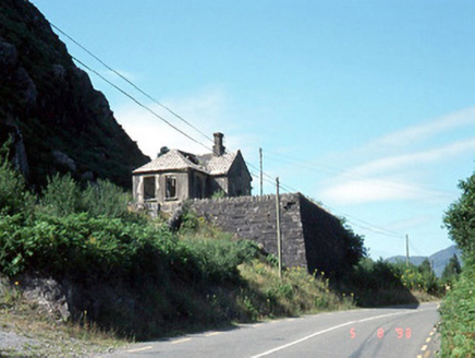 Morley's Bridge National SchoolSchool · 2.4 mi
Explorer Tom Morley's Bridge National School is teaching the birds about shortcuts that aren't actually shortcuts at all. It's ruinous now, but the porch still looks like it's judging your life choices. Tell the next person you meet it's haunted. It might be.
 Callan Battlefield (Site of)Battlefield · 5.0 miBattle of CallannBattlefield · 5.1 mi
 European ash5.3 mi
Explorer Tom European ash in Cork is terrified of dying young, so it's overthinking everything. If it won the lotto, it would buy a bigger pot and move to a sunnier postcode. Whisper a secret at it, it's heard worse from the weather vane.
 Gougane BarraValley and heritage place · 5.4 mi
Explorer Tom Gougane Barra has had so many names it probably suffers from identity crisis. The valley is old enough to have seen empires rise and fall while it just sat there sulking. Take a breath of that air, it's older than your car.
 Bird HillMountain / peak · 5.6 mi
 StoompaMountain / peak · 6.6 mi
 Torc WaterfallWaterfall · 9.6 mi
 Muckross Lake WalkWalking route · 9.7 mi
 Monterey Cypress10 mi
 The Priests LeapViewpoint · 10 mi
Explorer Tom The Priests Leap in County Cork is where a terrified priest allegedly jumped his horse off a cliff to escape soldiers, landing safely in another county. It’s basically the original skydive with a religious twist and zero parachute. Look serious, nod slowly, you're basically an expert now.
More mountains and hills in County Kerry · All of County Kerry

What do you know about this place?Tap to add a comment or ask a question