What is recorded here
Flash Burn Culvert, Farm Access Underbridge is a bridge in Scottish Borders, Scotland.
Places near here
Photo credits
- Maker not stated on source page, www.dreamstime.com
- Walter Baxter, Wikimedia Commons · CC BY-SA 2.0
- Oliver Dixon, Wikimedia Commons · CC BY-SA 2.0
- Richard Webb, Wikimedia Commons · CC BY-SA 2.0
- Peter Bond, Wikimedia Commons · CC BY-SA 2.0
- Maker not stated on source page, www.flickr.com
 Mapped cemeteryCemetery · 423 yd
 Castleton, St Martin's Church and ChurchyardBurial Ground, Church (medieval), Church (19th Century) · 427 yd
 Liddel CastleEarthwork, Fortification, Motte and Bailey (medieval) · 496 yd
 PowisholmFarmstead · 551 yd
 Lower Hermitage BankField Boundary(s) · 623 yd
 Castleton, CrossCross · 677 yd
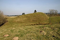 CastletonTownship (medieval) · 697 yd
 Castleton MuirStock Enclosure (post Medieval) · 796 yd
 RedheughTower House (medieval) · 804 yd
 Old CastletonRoad (medieval) · 858 yd
 Castleton Old Parish Church, SchoolroomSchool (19th Century), Session House (19th Century) · 1062 yd
 South GreenholmEnclosure, Field System, Rig and Furrow (medieval) - (post Medieval) · 1071 yd
More historic places in Scottish Borders · All of Scottish Borders

What do you know about this place?Tap to add a comment or ask a question