What is recorded here
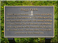
This brass commemorative plaque records: Flaggy Fields. These flags are believed to have been laid to allow weavers to cross between woollen mills (owned by the Ousey family in the early 19th century) at Ridge Hill and Heyrod. The path became a popular local walk long after the mills closed, leading down to the 'Bluebell Wood'. The farm called 'Clay Leaches' used to be the 'Black Horse' Inn.
Flaggy Fields consists of a series of stepping stones laid for weavers to traverse between mills owned by the Ousey family in the early 19th century; the path later became a beloved local walking route.
A plaque record does not grant entry to a building or private land. View it from a public place unless permission is clearly given.
Places near here
 Church of St GeorgeListed building · 657 yd
 Heyrod Hall BridgeListed building · 842 yd
 Stalybridge War MemorialMemorial · 1060 yd
 Stalybridge town hall monumentMonument or public art · 1125 yd
 Jack Judge StatueMonument or public art · 1163 yd
 Boundary Stone at HazelhurstMonument or public art · 1310 yd
 Hurst War MemorialMemorial · 1689 yd
 Bower FoldStadium · 1.3 mi
 Hough HillMountain / peak · 1.3 mi
 HarridgeMountain / peak · 1.7 mi
 Buckton CastleArchaeological place · 2.0 mi
 Hobson Moor Quarry (disused)Cliff · 2.3 mi
Other information
Photo: David Dixon on Geograph · CC BY-SA 2.0