
Places near here
Photo credits
- Eric Jones, Geograph · CC BY-SA 2.0
- Kenneth Allen, Geograph · CC BY-SA 2.0
- Picture: Sharon Cosgrove
- N Chadwick, Geograph · CC BY-SA 2.0
- Pulsar.co.nr, Wikimedia Commons · CC BY-SA 3.0
- Albert Bridge, Geograph · CC BY-SA 2.0
- Rossographer, Geograph · CC BY-SA 2.0
- Paul McIlroy, Geograph · CC BY-SA 2.0
- Picture: en.wikipedia.org
 Church & Graveyard & Coffin Lids (2): Ardkeen Church in ArdkeenChurch & Graveyard & Coffin Lids (2): Ardkeen Church · 1754 yd
Explorer Tom Church & Graveyard & Coffin Lids (2): Ardkeen Church in Ardkeen has seagulls who critique its architecture from above…
 Pherson's IslandIsland · 1.2 mi
Explorer Tom Pherson's Island is technically a drumlin that got promoted to island status after the sea level rose, which is like…
 Horse IslandIsland · 1.5 mi
Explorer Tom Horse Island in County Down would post on social media about its stunning views and how lucky everyone is to see it…
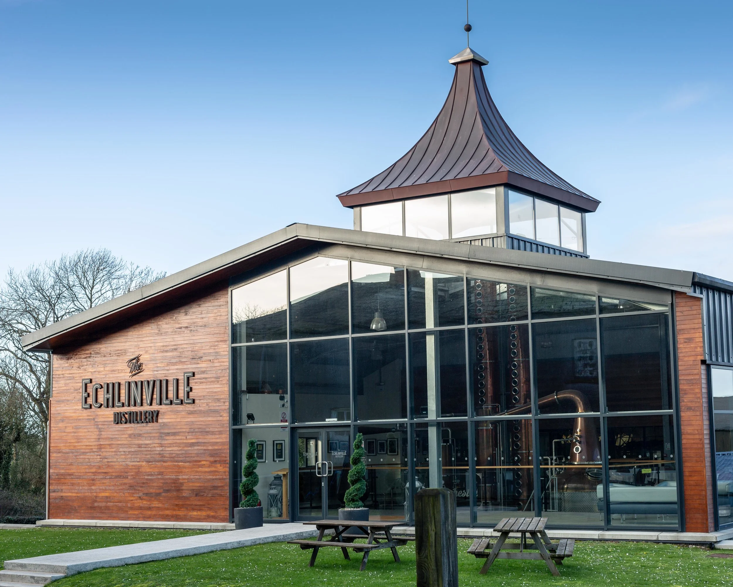 The Echlinville DistilleryHeritage attraction · 1.7 mi
Explorer Tom At 62 Gransha Road near Kircubbin, Echlinville Distillery begins its story in the Ards Peninsula fields, where the…
 Sketrick Castle (ruin)Castle · 5.2 mi
Explorer Tom Sketrick Castle is a ruin that hears every whisper about it being 'just a mound' and gets incredibly offended by the…
 Tower-house, bawn & passage to spring: sketrick castle in Sketrick IslandTower-house, Bawn & Passage to Spring: Sketrick Castle · 5.2 mi
Explorer Tom Sketrick Castle has a passage to a spring, so the builder definitely had a plan B for thirst. I’d say it’s fancy, but…
 Nendrum monastic site in Mahee IslandNendrum Monastic Site · 5.6 mi
Explorer Tom Nendrum monastic site in Mahee Island is having a massive feud with that one big tree right next door. The monks wanted…
 The Round TowerVisitor information · 5.6 mi
Explorer Tom The Round Tower is still confused about why the Vikings couldn't find it, even though it's been standing there…
 Post-Medieval church & graveyard in TullynakillPost-Medieval church & graveyard · 7.1 mi
Explorer Tom Post-Medieval church & graveyard in Tullynakill has a thick wall on the north side. That’s not a coincidence, that’s a…
 Delamont Country ParkVisitor information · 7.2 mi
Explorer Tom Delamont Country Park in County Down has officially given up chocolate for Lent, which explains why it looks so stern…
 Strangford WalkWalking route · 7.4 mi
Explorer Tom Strangford Walk has a secret talent for making you feel like you’re in a very slow-motion nature documentary. There’s…
 Bright GAA GroundGAA ground · 13 mi
More archaeology and monuments in County Down · All of County Down

What do you know about this place?Tap to add a comment or ask a question