What is recorded here
Not indicated on either the 1837 or 1913 edition of the OS 6-inch map. Situated atop an exposed summit of rocky hillock, in undulating mountain pasture on slight NNE-facing slope c.100m to the N of a now disused barytes mine. Views are good to excellent in all directions except W where obscured by higher ground. Complex, comprising the remains of three buildings (SL009-004001-; SL009-004002-; SL009-004003-), at least two of which are booley huts or small houses, associated with a field (SL009-004----). The field comprises a roughly rectangular area (L N-S 16m; Wth E-W 14m) defined by the footings of drystone walls. The E wall is absent. The field walls enclose enclosing a booley hut (SL009-004002-) at the NE corner and a second building (SL009-004003-) at NW corner. The remains are almost certainly post-1700 AD in date.
Compiled by: Patrick F. O'Donovan
Date of upload: 02 August 2012
The monument record does not grant public access. Check the route and ask the landowner before entering private land.
- What survives
- Recorded monument
Places near here
 Gleniff Barytes MineRuins · 104 yd
 Annacoona TopMountain / peak · 1268 yd
 Glencar Lough ViewpointViewpoint · 1.0 mi
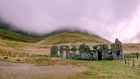 Gleniff School RuinsRuins · 1.1 mi
 Dermot & Grania's BedCave · 1.2 mi
 Doneen WestCliff · 1.6 mi
 Dooneen SouthMountain / peak · 1.6 mi
 Noble 6 MonumentMonument · 1.7 mi
 IndicatedFairy fort / earthen ringfort · 1.8 mi
 Memorial Francis FinnMemorial · 1.8 mi
 Glencar WaterfallVisitor information · 2.1 mi
 Glencar IslandIslet · 2.2 mi