What is recorded here
In rough pasture, on a NE-facing slope, at the SE end of Reenadrolaun Point. This network of relict field walls is indicated by the remains of both linear and curvilinear walls (Wth c. 0.7m; H c. 0.9m) which occur intermittently in an irregular-shaped area (c. 120m NW-SE; c. 60m NE -SW). Upright stones from the walls protrude above the ground surface at irregular intervals. Elsewhere the remains consist of a scatter of stones on the ground surface. No definite field pattern was noted at ground level. There is a hut site (KE078-001----) to the NW. (See O'Sullivan and Sheehan 1996, 401, no. 1258)
The above description is derived from the published 'Archaeological Inventory of County Kerry. Volume I: South-West Kerry' (Dublin: Stationery Office, 2009).
In rough pasture, on a NE-facing slope, at the SE end of Reenadrolaun Point. This network of relict field walls is indicated by the remains of both linear and curvilinear walls (Wth c. 0.7m; H c. 0.9m) which occur intermittently in an irregular-shaped area (c. 120m NW-SE; c. 60m NE -SW). Upright stones from the walls protrude above the ground surface at irregular intervals. Elsewhere the remains consist of a…
From the National Monuments Service (Archaeological Survey of Ireland) record KE078-001001
The monument record does not grant public access. Check the route and ask the landowner before entering private land.
- What survives
- Recorded monument
Places near here
Photo credits
- Phil Champion, Geograph · CC BY-SA 2.0
- Jonathan Billinger, Wikimedia Commons · CC BY-SA 2.0
- Doug Snider, Wikimedia Commons · Public domain
- Dennis Turner, Geograph · CC BY-SA 2.0
- Peter Craine, Wikimedia Commons · CC BY-SA 2.0
- Kurt Stüber [1], Wikimedia Commons · CC BY-SA 3.0
- Draceane, Wikimedia Commons · CC BY-SA 4.0
- National Inventory of Architectural Heritage
- Jibi44, Wikimedia Commons · CC BY-SA 2.5
- John ., Wikimedia Commons · CC BY 2.0
- Hywel Williams, Geograph · CC BY-SA 2.0
 Tetrapod TrackwayArchaeological place · 296 yd
 Tetrapod TrackwayArchaeological place · 340 yd
 GeokaunMountain / peak · 961 yd
 Fogher CliffCliff · 1023 yd
 Cromwell PointHeadland · 1.1 mi
 Cromwell Point LighthouseLighthouse · 1.1 mi
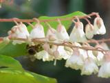 Lily-of-the-valley tree1.3 mi
 Chilean myrtle1.3 mi
 Glanleam HouseMill (water) · 1.3 mi
 ValentiaIsland · 1.7 mi
 Beginish IslandIsland · 2.0 mi
 Culloo RockViewpoint · 2.2 mi
More archaeology and monuments in County Kerry · All of County Kerry
What do you know about this place?