
What is recorded here
These possible field walls are not visible at ground level. A network of relict field walls, covering an area c. 200m by c. 140m, is visible as a shadow site in an aerial photograph (OSAP, 2119-2120) taken in 1989. On the 1846 OS 6-inch map the area is covered in woodland and, according to local information, this oak woodland was cut down during World War 1. Two archaeological trial trenches in the area, undertaken because of a proposed housing development, revealed no features of archaeological significance (Bennett 1995, 44). The features that were visible in the aerial photograph were not apparent at ground level prior to trial trenching (pers. comm. I. Bennett). An enclosure (KE066-106001-), which is also visible in the aerial photograph, lies c. 300m to the SE.
Compiled by: Elizabeth Byrne, Ursula Egan and Sheila Ronan, Archaeological Survey Unit, University College, Cork.
Date of upload: 31 January 2011
The monument record does not grant public access. Check the route and ask the landowner before entering private land.
- What survives
- Recorded monument
Places near here
 Enclosure in Deerpark (magunihy By.)Enclosure · 280 yd
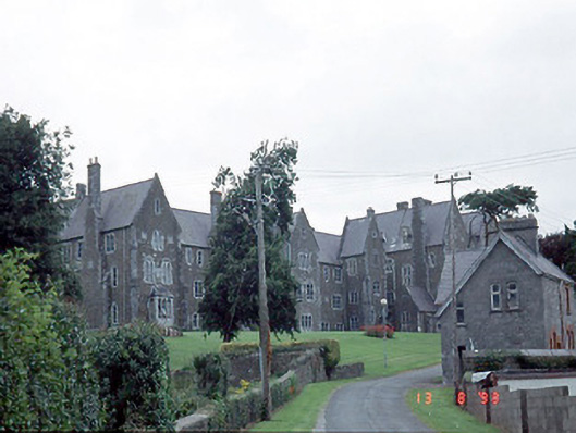 Saint Finan's Hospitalhospital/infirmary · 793 yd
 Coolcorcoran BridgeBridge · 835 yd
 Enclosure in BallydribbeenEnclosure · 926 yd
 Famine MemorialMemorial · 1146 yd
 Kerry 2nd Brigade of the Irish Republican ArmyMemorial · 1158 yd
 GinkgoGinkgo · 1167 yd
 Jaunting ToursHeritage attraction · 1551 yd
 Giant SequoiaGiant Sequoia · 1.0 mi
 Circular WalkWalking route · 1.3 mi
 Flesk CastleCastle · 1.6 mi
 Mass RockNamed rock · 1.7 mi
Other information
Photo: Credit not shown in the picture search · Rights wording not checked; contact us if this picture should be removed