What is recorded here
On White Strand at inner end of Crookhaven Bay. Row of fifteen contigious upright stones (H 0.5-1.6m) aligned c. E-W, apart for two stones at western end aligned N-S. Outlyer 8m N of row (H 1.3m; 0.7m x 0.2m) aligned N-S. Only top half of stones visible at high tide. According to Mitchell (1976, 182) probable part of submerged field boundary.
From the National Monuments Service (Archaeological Survey of Ireland) record CO152-005
The monument record does not grant public access. Check the route and ask the landowner before entering private land.
- What survives
- Recorded monument
Places near here
Photo credits
- Mac McCarron, Geograph · CC BY-SA 2.0
- National Inventory of Architectural Heritage
- Richard Webb, Geograph · CC BY-SA 2.0
- Graham Horn, Geograph · CC BY-SA 2.0
- Minseach, Wikimedia Commons · CC BY-SA 4.0
- L J Cunningham, Wikimedia Commons · CC BY-SA 2.0
- Richard Webb, Wikimedia Commons · CC BY-SA 2.0
- Superbass, Wikimedia Commons · CC BY-SA 4.0
- D.Camier, Wikimedia Commons · CC BY-SA 4.0
- Mick Garratt, Geograph · CC BY-SA 2.0
Fish palace in BallynauleFish palace · 419 yd Galley Cove BeachBeach / strand · 508 ydBrowhead Signal StationSignal tower · 1437 ydBrow Head Signal TowerRuins · 1438 ydBarley CoveBeach / strand · 1.2 miCreamery PlatformMemorial · 1.3 miBarley CoveHeritage attraction · 1.4 miMizen PeakMountain / peak · 2.5 miKnocknamaddreeMountain / peak · 3.1 miThree Castles (in Ruins)Castle, tower house · 3.7 miWedge tomb in AltarWedge tomb · 5.6 miAltarViewpoint · 5.7 mi
 Galley Cove BeachBeach / strand · 508 yd
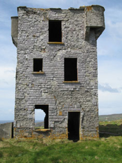 Browhead Signal StationSignal tower · 1437 yd
 Brow Head Signal TowerRuins · 1438 yd
 Barley CoveBeach / strand · 1.2 mi
 Creamery PlatformMemorial · 1.3 mi
 Barley CoveHeritage attraction · 1.4 mi
 Mizen PeakMountain / peak · 2.5 mi
 KnocknamaddreeMountain / peak · 3.1 mi
 Three Castles (in Ruins)Castle, tower house · 3.7 mi
 Wedge tomb in AltarWedge tomb · 5.6 mi
 AltarViewpoint · 5.7 mi
More archaeology and monuments in County Cork · All of County Cork
What do you know about this place?