What is recorded here
From OpenStreetMap (© OpenStreetMap contributors) n3825433196
Places near here
Photo credits
- This file is from the Mechanical Curator collection , a set of over 1 million images scanned from out-of-copyright books and released to Flickr Commons by the British Library. View image on Flickr View all images from book View catalogue entry for book ., Wikimedia Commons · Public domain
- D Gore, Geograph · CC BY-SA 2.0
- D Gore, Geograph · Creative Commons Attribution-ShareAlike 2.0
- National Inventory of Architectural Heritage
- Eric Jones, Wikimedia Commons · CC BY-SA 2.0
- Architecture of Dublin, Wikimedia Commons · Public domain
- Pamela Norrington, Wikimedia Commons · CC BY-SA 2.0
 Back WoodForest · 542 yd
Explorer Tom Back Wood is a simple name for a complex ecosystem hiding right behind the main scenes of this county.
 Dartrey ForestForest · 719 ydDiamond HillMountain / peak · 724 yd
Explorer Tom Diamond Hill in County Cavan sounds like it’s hiding a treasure chest, though probably just a lovely panoramic view.
 Dartrey HouseMonument · 747 yd
 Church of Saint John the Evangelist (Ematris)Church/chapel · 967 yd
 Holy Trinity Catholic ChurchChurch/chapel · 1178 yd
 Dawson MonumentMonument · 1202 yd
 Flagpole HillMountain / peak · 1619 yd
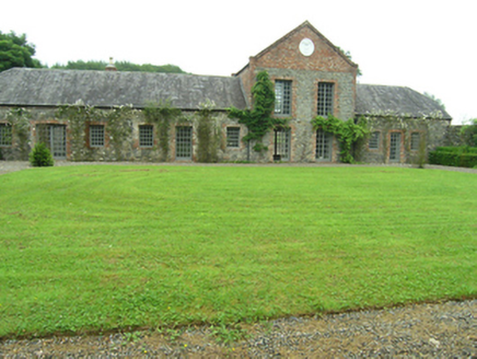 Bellamont HouseOutbuilding · 1.1 mi
Explorer Tom Bellamont House outbuildings date to around 1730 and feature a substantial L-plan block with a walled garden frontage.
 The RectoryRectory/glebe/vicarage/curate's house · 1.1 mi
 Bellamont ForestCountry house · 1.2 mi
Explorer Tom Bellamont Forest is a Palladian-style country house built circa 1730, boasting a central Doric entrance portico and red brick chimneystacks.
 Cabragh RingfortArchaeological place · 3.9 mi
Explorer Tom Cabragh Ringfort is recorded as an archaeological place in County Cavan, likely a circular dwelling spot surrounded by banks that protected its ancient residents.
More mountains and hills in County Monaghan · All of County Monaghan
What do you know about this place?Tap to add a comment or ask a question