What is recorded here
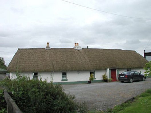
Detached five-bay single-storey direct entry thatched farmhouse, extant 1837, on a rectangular plan with single-bay single-storey lean-to windbreak. Hipped oat straw thatch roof overhanging lean-to slate roof (windbreak), rope twist ridge with grouped exposed stretchers having exposed scallops, rendered dwarf chimney stacks supporting terracotta or yellow terracotta tapered pots, and blind stretchers to eaves having blind scallops. Roughcast battered walls on rendered plinth. Square-headed door opening with concealed dressings framing timber panelled door. Square-headed window openings with concrete or rendered sills, and concealed dressings framing one-over-one timber sash windows. Set perpendicular to road with roughcast piers (south) or roughcast cylindrical piers (north) having capping supporting flat iron double gates.
A farmhouse identified as an important component of the vernacular heritage of County Kildare by such attributes as the alignment perpendicular to the road; the elongated rectilinear direct entry plan form; the construction in unrefined local fieldstone displaying a battered silhouette with sections of "daub" or mud suggested by an entry in the "House and Building Return" Form of the National Census (NA 1901; NA 1911); the disproportionate bias of solid to massing; and the high pitched roof showing an oat straw thatch finish. Having been well maintained, the form and massing survive intact together with substantial quantities of the original fabric, both to the exterior and to the interior, thus upholding the character or integrity of the composition. Furthermore, adjacent "tin roofed" outbuildings (----) continue to contribute positively to the setting of a self-contained ensemble making a pleasing visual statement in a rural street scene.
This does not grant access. Most recorded buildings are privately owned; view them only from public ground unless the owner allows entry.
Places near here
 Enclosure in Ballynagappagh (clane Ed)Enclosure · 1222 yd
 Loughanure MoatEnclosure · 1622 yd
 Queen Buans GraveCastle, motte and bailey · 1.2 mi
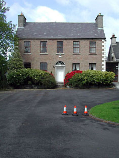 Curryhills Househouse · 1.2 mi
 Burial GroundRuins · 1.3 mi
 Grand Canal WayWalking route · 1.6 mi
 CastleCastle, tower house · 1.7 mi
 The Kildare MazeHeritage attraction · 1.7 mi
 1798 Rebellion MemorialMemorial · 1.7 mi
 Venerable Fr John Sullivan MemorialMemorial · 1.9 mi
 Loughtown CovertWood · 2.4 mi
 Dunne's IslandWood · 2.4 mi
Other information
Photo: National Inventory of Architectural Heritage · Website use allowed for educational or private purposes with source credit