
What is recorded here
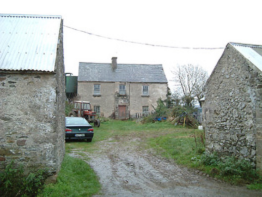
Detached four-bay two-storey farmhouse, c.1825, with lean-to entrance windbreak to ground floor. Mostly refenestrated, c.1975. Pitched slate roof (lean-to to windbreak) with clay ridge tiles, red brick Running bond chimney stack, rendered coping, and iron rainwater goods on slightly overhanging rendered eaves having iron brackets. Painted rendered walls. Square-headed window openings with painted dressed stone sills, and replacement aluminium casement windows, c.1975, retaining fixed-pane timber windows to first floor. Square-headed door opening with replacement timber panelled door, c.1975. Set in own grounds perpendicular to road with painted rendered piers having unpainted pebbledashed panels, and rendered domed capping having finials. (ii) Attached single-bay single-storey outbuilding, pre-1903. Reroofed. Pitched roof with replacement corrugated-iron, iron ridge, and no rainwater goods. Unpainted rendered walls. Square-headed window openings with concealed dressings, and fittings not visible. Square-headed door opening with timber lintel, and timber boarded door. (iii) Detached six-bay single-storey outbuilding, pre-1903. Pitched slate roof with clay ridge tiles, and no rainwater goods on rendered eaves. Unpainted rendered walls. Square-headed window openings with concealed dressings, and fittings not visible. Square-headed door openings with concealed dressings, and timber boarded doors.
A modest-scale farmhouse of unassuming architectural aspirations retaining the original composition attributes together with substantial quantities of the historic fabric: however, the systematic replacement of the fittings to the openings with inappropriate modern articles threatens to further undermine the character of the house. A collection of attendant outbuilding ranges enhances the group and setting values of the site in a rural setting.
This does not grant access. Most recorded buildings are privately owned; view them only from public ground unless the owner allows entry.
Places near here
 TobernakillHoly well · 1329 yd
 Church (in Ruins)Church · 1470 yd
 farmyard complexfarmyard complex · 1.1 mi
 Pollrone House (site of)Archaeological place · 1.2 mi
 Waterford & Suir Valley RailwayHeritage attraction · 2.1 mi
 CastleCastle, unclassified · 2.3 mi
 Rockets Castle (in ruins)Castle, tower house · 2.3 mi
 Glenhouse WoodForest · 2.4 mi
 Sargent's magnoliaSargent's magnolia · 2.5 mi
 Portlaw Heritage CentreMuseum · 2.6 mi
 Donnell's HillMountain / peak · 3.2 mi
 Tower HillMountain / peak · 4.9 mi
Other information
Photo: National Inventory of Architectural Heritage · Website use allowed for educational or private purposes with source credit