
Places near here
Photo credits
- Kenneth Allen, Geograph · CC BY-SA 2.0
- Kenneth Allen, Wikimedia Commons · CC BY-SA 2.0
- R.D Photography (watermark); photograph published by Glenullin GAC on its own fundraising page, www.crowdfunder.co.uk
- Cormac Duffin, Geograph · CC BY-SA 2.0
- Richard Webb, Geograph · CC BY-SA 2.0
- Michael Murtagh, Geograph · CC BY-SA 2.0
- Robert Ashby, Wikimedia Commons · CC BY-SA 2.0
- Robert Ashby, Geograph · CC BY-SA 2.0
Explorer Tom Bivallate rath: Farrantemple court in Farrantemple Glebe has had endless drama with the nearest tree about who gets…
 Church, Graveyard & Bullaun ('font'): Errigal Church, Errigal Adamnan or St Adamnan's Church in BallintempleChurch, Graveyard & Bullaun ('font'): Errigal Church, Errigal Adamnan or St Adamnan's Church · 1246 yd
Explorer Tom Errigal Church in Ballintemple is listening to every whisper like a gossiping aunt. It’s been there since St Adamnan’s…
 Errigal Old ChurchRuins · 1273 yd
Explorer Tom Errigal Old Church’s favourite song is probably 'Lean on Me' because it’s leaning pretty heavily on its neighbour…
Children's playground1.0 miExplorer Tom Children's playground in County Derry hates its least favourite visitor: a pigeon that stares at you while eating…
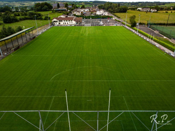 Páirc Sheáin Uí Mhaoláin, John Mitchel's GAA, GlenullinGAA ground · 1.1 mi
 Gortnamoyagh ForestForest · 3.7 mi
Explorer Tom The weather has a long-standing grudge against this Gortnamoyagh Forest, sending rain and wind to see if it will…
 Legananam PotCliff · 4.3 mi
Explorer Tom Legananam Pot in County Derry isn't actually a pot but a glacial meltwater channel, which is a bit of a letdown for…
 Donald's HillMountain / peak · 5.1 mi
Explorer Tom Donald's Hill in County Derry has a bird that refuses to leave no matter how bad the weather gets or how rude the…
 Carn HillMountain / peak · 5.8 mi
Explorer Tom Carn Hill would order a massive portion of chips with extra gravy if it could get to the chippy downstairs. It's…
Scroggy Mass RockNamed rock · 9.6 miExplorer Tom Scroggy Mass Rock in County Derry is just sitting there, looking rough, probably because it hasn't had a good scrub…
 Salters Castle (Ruins)Ruins · 21 mi
Explorer Tom Salters Castle Ruins would win a county fair for 'Most Dramatic Decline' or 'Best Looking Mess.' It’s basically a pile…
 Plantation Castle; Bawn; Village Site: Salterstown or Salter's Castle in BallymultreaPlantation Castle · 21 mi
Explorer Tom Salter’s Castle was named after a guy who probably overcharged for salt. The village site is where he likely argued…
More archaeology and monuments in County Derry · All of County Derry

What do you know about this place?Tap to add a comment or ask a question