What is recorded here
Falleninch Farm is a farmhouse in Stirling, Scotland.
Places near here
Picture notes
- Andrew Smith, Wikimedia Commons · CC BY-SA 2.0
- Robert Murray, Wikimedia Commons · CC BY-SA 2.0
- Christine Johnstone, Wikimedia Commons · CC BY-SA 2.0
- Computer-made picture. It does not show this playground.
- Lairich Rig, Wikimedia Commons · CC BY-SA 2.0
- Computer-made picture. It does not show this garden.
- Maker shown on the Wikimedia Commons file page · CC BY-SA 3.0
- David Dixon, Wikimedia Commons · CC BY-SA 2.0
- LeCardinal, Wikimedia Commons · CC BY-SA 3.0
- Euan Nelson, Wikimedia Commons · CC BY-SA 2.0
 South KersebonnyFarmstead, Horse Engine House (19th Century) - (20th Century) · 715 yd
 St Thomas's WellBurial Ground, Chapel, Well · 819 yd
 StirlingGrenade Range (second World War) · 840 yd
 Children's playground965 ydTom: I’m here to help · Computer-made picture. It does not show this playground.
 King's Park FarmBarn(s) (19th Century), Farmstead (19th Century) · 1034 yd
 Douglas GardenGarden · 1324 ydTom: I’m here to help · Computer-made picture. It does not show this garden.
 Battle of StirlingBattle · 1471 yd
_-_geograph.org.uk_-_964954.jpg/250px-Monument_to_Margaret_Wilson_(a_Wigtown_Martyr)_-_geograph.org.uk_-_964954.jpg "Photo: Lairich Rig, Wikimedia Commons · CC BY-SA 2.0") Wilson MonumentMemorial · 1475 yd
Wilson MonumentMemorial · 1475 yd Robert the Bruce MonumentMemorial · 1476 yd
 Gowan HillMountain / peak · 1495 yd
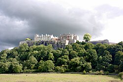 Siege of Stirling CastleSiege · 1580 yd
 Mote HillMountain / peak · 1.0 mi
More historic places in Stirling · All of Stirling

What do you know about this place?Tap to add a comment or ask a question