What is recorded here
Fairy forts are not for the living. This one sits at the foot of Sheemore Hill, a shallow grassy circle marked by a low stone spread and a field wall that cuts through its northern edge. People may have lived there before becoming a warning, but the shape still belongs to the fairies. Keep your distance and do not throw stones into it.
Located at the N-facing foot of Sheemore Hill. This is a grass-covered circular area (int. diam. 32.5m E-W) defined by a scarp W-NE while two sections of a grass-covered stone spread (Wth 2.5m; int. H 0.3m; ext. H 0.2m) survive at E and SW. It is truncated by a NW-SE field wall at N and disturbed by farm outbuildings at NW.
The above description is derived from 'The Archaeological Inventory of County Leitrim' compiled by Michael J. Moore (Dublin: Stationery Office, 2003). In certain instances the entries have been revised and updated in the light of recent research.
Date of upload: 23 September 2008
The monument record does not grant public access. Check the route and ask the landowner before entering private land.
- What survives
- Recorded monument
Places near here
 Enclosure in SheemoreEnclosure · 108 yd
 Leabaidh DermotCave · 131 yd
 Fairy fort / stone ringfort in SheemoreFairy fort / stone ringfort · 220 yd
 Sheemore Ambush MemorialMonument · 803 yd
 Church (in Ruins)Church · 1.4 mi
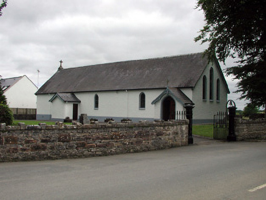 Saint Joseph's Catholic Churchchurch/chapel · 1.7 mi
 Shannon-Erne WaterwayVisitor information · 1.8 mi
 Sit of Breifny CastleCastle, tower house · 1.8 mi
 Battle of Áth an Chipbattle · 2.3 mi
 PortCastle, unclassified · 2.4 mi
 InishnagonIsland · 2.7 mi
 Rusheen IslandIslet · 3.4 mi