What is recorded here
No human has entered the underground passage since the last camera battery died, though the stones still stand twenty metres across on the hilltop. The fort overlookes Kilcorney Valley, waits for curiosity, and keeps its own time.
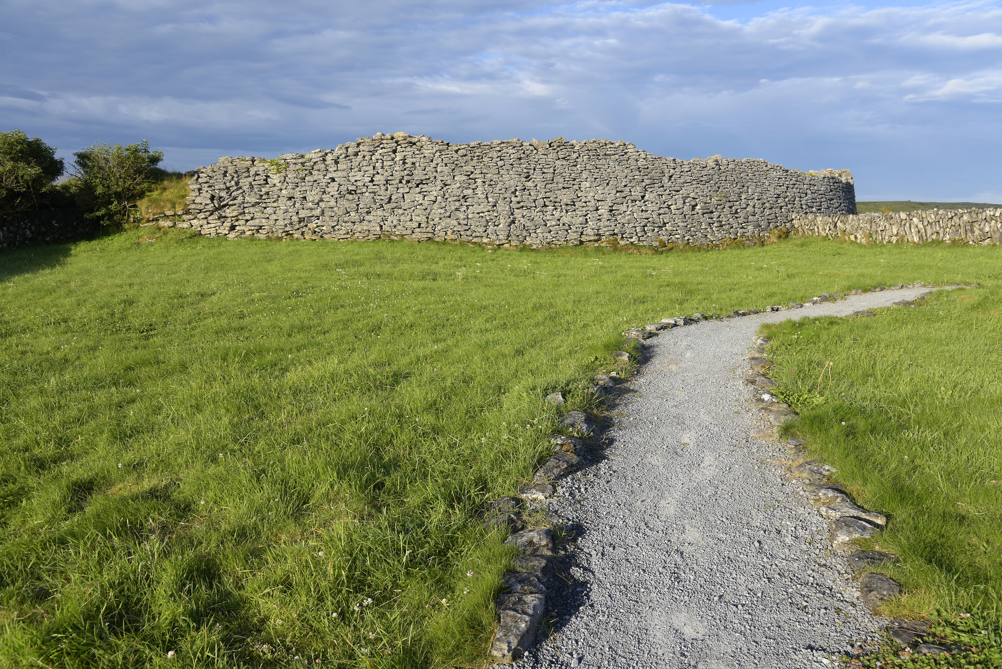
At the N edge of a broad hilltop, in rough pasture overlooking Kilcorney Valley to N and with wide views all around except to SSW where the ground rises, and within a multiperiod field system (CL009-032001-). Hachured on the OS 25-inch plan (1897) and Cassini edition (1920) of the OS 6-inch map. Listed as ‘Enclosure’ in the RMP (1996). This raised subcircular area (diams. 24m N–S; c. 20.5m E–W) is defined by a drystone wall built of horizontally laid stones (av. Wth c. 2.5m; ext. H 1.4–1.7m). The outer wall-face is best preserved from N–NE and at SW. The interior contains a Man-made underground passage (CL009-032005-) in the N sector.
An enclosure (CL009-150----) lies c. 107m to NE. A cairn (CL009-032010-) lies c. 144m to SSW.
Compiled by: Gearóid Conroy and Conn Herriott
Date of upload: 30-9-2025
The monument record does not grant public access. Check the route and ask the landowner before entering private land.
- What survives
- Recorded monument
Places near here
 IndicatedEnclosure · 138 yd
 Poulawack CairnArchaeological place · 246 yd
 Caherconnell Stone FortRuins · 887 yd
 Cave of the Wild HorsesCave · 1301 yd
 Poulnabrone - Burren GeositeVisitor information · 1598 yd
 Carran Church (in ruins)Church · 1635 yd
 The Portal TombVisitor information · 1737 yd
 Poulnabrone DolmenHeritage attraction · 1.0 mi
 Gleansleade Castle (in ruins)Castle, tower house · 1.4 mi
 PoulnabroneMemorial · 1.6 mi
 Gleninshing tombHeritage attraction · 1.8 mi
 Farbrega RockNamed rock · 1.9 mi