What is recorded here
Fairy fort / stone ringfort in Mweelroe is a fairy fort or stone ringfort in Mweelroe, County Sligo, Ireland. It occupies the flat summit of a drumlin ridge with panoramic views. The oval enclosure measures 11.2m east-west and 9.8m north-south, bounded by a flat-topped sod-covered stone wall 2.5m thick. Portions of the east and southeast wall have been partially removed, though inner and outer boulder facings remain visible at the southeast.
On the flat summit of a drumlin ridge, with panoramic views. An oval area (11.2m E-W; 9.8m N-S) enclosed by a flat-topped sod-covered stone wall (T 2.5m; int. H 0.6m; ext. H 0.8m). Portions of the wall at E and SE have been partially removed; remains of an inner and outer facing of boulders is evident at SE. The interior is level. The cashel is indicated on the 1942-3 OS 6-inch map by an arc of hachures SW-NW.
The above description is derived from the published 'Archaeological Inventory of County Sligo' compiled by Ursula Egan, Elizabeth Byrne, Mary Sleeman with Sheila Ronan and Connie Murphy (Dublin Stationery Office, 2005).
Date of upload: 18 January 2008
The monument record does not grant public access. Check the route and ask the landowner before entering private land.
- What survives
- Recorded monument
Places near here
 Indicated (1838).Enclosure · 1.1 mi
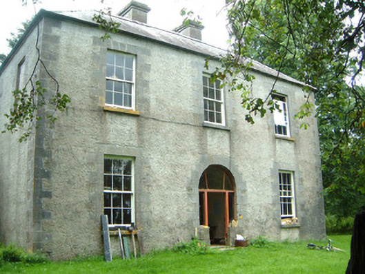 Redhill Househunting/fishing lodge · 1.2 mi
 IndicatedFairy fort / stone ringfort · 1.3 mi
 Church in BattlefieldChurch · 1.7 mi
 Moygara Castle (in Ruins)Bawn · 2.0 mi
 Moygara CastleCastle · 2.0 mi
 Curlew MountainsMountain / peak · 2.7 mi
 Crow IslandIslet · 2.9 mi
 Inch IslandIslet · 3.3 mi
 Castle PointHeadland · 3.5 mi
 Caves of KeshCave · 4.2 mi
 Rose PointHeadland · 4.3 mi