What is recorded here
Knocknagroagh holds a forty-four-metre stone ring on an elevated slope above Ballyvaghan valley, marked as an enclosure since 1840. Its south entrance and surviving inner facing suggest people once lived inside the circle before later walls and pasture changed the shape. The nearby cairn and lost western enclosure imply a small neighbourhood rather than a lonely heap, perhaps watching the valley or keeping what cannot be measured.
On a slightly elevated SE-facing slope in improved pasture on the E side of Ballyvaghan valley. Hachured on the 1840 and 1916 eds. of the OS 6-inch map and listed as an ‘Enclosure’ in the RMP (1996). A circular cashel (diam. 44m) defined by a wall from WNW to E (est. original Wth 1.8m; max. H 1.5m) and by a stone spread from E to WNW (Wth 3.2-4m; H 1m), with an entrance (Wth 2m) at S, that may be original. Outer wall-facing survives at SW, NW and N and inner facing at E. A later wall runs on the line of the cashel wall at E. A cairn (CL005-230----) is located c. 10m SW of the cashel and a no longer discernible enclosure is located c. 120m to the W (CL005-046----).
Compiled by: Mary Tunney and Ros Ó Maoldúin
Date of upload: 28 March 2022
The monument record does not grant public access. Check the route and ask the landowner before entering private land.
- What survives
- Recorded monument
Places near here
 Enclosure in KnocknagroaghEnclosure · 160 yd
 OoanknocknagroaghFairy fort / stone ringfort · 271 yd
 Catholic Church of Saint John the Baptistchurch/chapel · 1335 yd
 Newtown CastleCastle, tower house · 1337 yd
 Bird Of Prey CentreHeritage attraction · 1501 yd
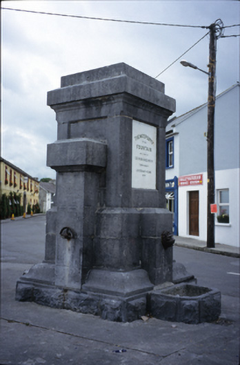 Ballyvaghan Fountainfountain · 1577 yd
 Aillwee CaveCave · 1.0 mi
 Ballyvaghan Castle (in ruins)Castle, unclassified · 1.1 mi
 Rine PointHeadland · 2.0 mi
 CappanawallaMountain / peak · 2.3 mi
 Gleninshing portal tombHeritage attraction · 2.6 mi
 PoulnabroneMemorial · 3.7 mi